Cof Cymru: National Historic Assets of Wales · Wales
Barn N of Pen-y-Bryn
Bro Machno, Conwy, Wales
A scheduled monument in Bro Machno, Conwy, recorded as Barn (Post Medieval/Modern).
The record
- Designation
- Scheduled monument
- Site type
- Barn
- Period
- Post Medieval/Modern
- Community
- Bro Machno
- Unitary authority
- Conwy
- Country
- Wales
- Coordinates (centre of the scheduled area)
- 53.03627, -3.81049
- SAM number
- CN139
- Cadw record number
- 3393
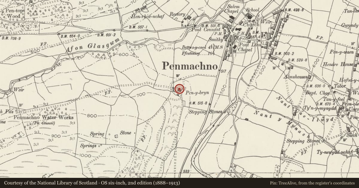
Slide toward Today to fade the historical sheet and see the modern map underneath.
David Rumsey Map Collection, Stanford LibrariesDavid Rumsey Map Collection, Stanford LibrariesDavid Rumsey Map Collection, Stanford LibrariesBayerische Staatsbibliothek, MunichLlyfrgell Genedlaethol Cymru – The National Library of Wales
5 historical maps cover this location, the earliest the 1588 map "Ortelius, Abraham: Theatro De La Tierra Universal. 0" (Bayerische Staatsbibliothek, Munich).
Historical maps covering this location
- 1588 · Ortelius, Abraham: Theatro De La Tierra Universal. 0 (Bayerische Staatsbibliothek, Munich)
- 1608 · (13) Cambriae Typus. (David Rumsey Map Collection, Stanford Libraries)
- 1795 · To Sir Watkin Williams-Wynn Bart ... the map of the six counties of North Wales is most… (Llyfrgell Genedlaethol Cymru – The National Library of Wales)
- 1899 · 119 Snowdon (Hills) (David Rumsey Map Collection, Stanford Libraries)
- 1901 · Sheet 9 and 10. (David Rumsey Map Collection, Stanford Libraries)
Cadw's description
Summary description and reason for designation
The following provides a general description of the Scheduled Monument.
The monument consists of a barn dating to the 17th century. It is built of partly coursed slate rubble with fine slate quoins. The barn is of five bays: the NW bay is divided from the rest of the barn by a timber partition, and this bay is entered from a doorway in the NW gable end; this bay has been lofted over. The next bay contains wide opposing doorways, each with a lintel on corbels above. The door heads are segmental, with long, shaped voussoirs. The remaining bays are each lit by opposing slits. The roof is supported on four through-purlin collar and tie beam trusses. The SE gable and the NW end of the barn have been rebuilt, and the entire barn has been re-roofed with the original trusses retained but with many new rafters. A lean-to shed formerly against the NW end of the N wall has been removed.
The monument is of national importance for its potential to enhance our knowledge of post-medieval settlement and agricultural practices. It retains significant archaeological potential, with a strong probability of the presence of associated archaeological features and deposits. The structure itself may be expected to contain archaeological information concerning chronology and building techniques, together with a strong probability of environmental evidence. A barn may be part of a larger cluster of monuments and their importance can further enhanced by their group value.
The scheduled area comprises the remains described and areas around them within which related evidence may be expected to survive.
Nearby in the register
- Pen-y-Bryn BarnAgriculture and Subsistenceunder 1 mi
- Pen-y-Bryn Farmhouse & attached Agricultural RangeDomesticunder 1 mi
- Bethania ChapelReligious, Ritual and Funeraryunder 1 mi
- Parish Church of St TudcludReligious, Ritual and Funeraryunder 1 mi
Other entries of the same register within about three miles of this one, by straight line.