Cof Cymru: National Historic Assets of Wales · Wales
Bwlch y Ddeufaen Standing Stones
Caerhun, Conwy, Wales
A scheduled monument in Caerhun, Conwy, recorded as Standing Stone (Prehistoric).
The record
- Designation
- Scheduled monument
- Site type
- Standing Stone
- Period
- Prehistoric
- Community
- Caerhun
- Unitary authority
- Conwy
- Country
- Wales
- Coordinates (centre of the scheduled area)
- 53.22765, -3.92730
- SAM number
- CN129
- Cadw record number
- 557
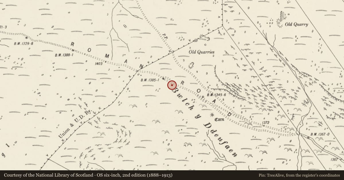
Slide toward Today to fade the historical sheet and see the modern map underneath.
David Rumsey Map Collection, Stanford LibrariesDavid Rumsey Map Collection, Stanford LibrariesDavid Rumsey Map Collection, Stanford LibrariesDavid Rumsey Map Collection, Stanford LibrariesDavid Rumsey Map Collection, Stanford Libraries
5 historical maps cover this location, the earliest the 1883 map "Watershed map England, Wales 3." (David Rumsey Map Collection, Stanford Libraries).
Historical maps covering this location
- 1883 · Watershed map England, Wales 3. (David Rumsey Map Collection, Stanford Libraries)
- 1896 · Sheet 7. Ordnance Survey of England and Wales. (David Rumsey Map Collection, Stanford Libraries)
- 1899 · 106 Bangor (Outline) (David Rumsey Map Collection, Stanford Libraries)
- 1899 · 106 Bangor (Hills) (David Rumsey Map Collection, Stanford Libraries)
- 1901 · Sheet 9 and 10. (David Rumsey Map Collection, Stanford Libraries)
Cadw's description
Summary description and reason for designation
The following provides a general description of the Scheduled Ancient Monument.
The monument comprises the remains of a two standing stones and a cairn
1, a standing stone c.3.5m high by 1.5m by 1.2m, rising to a blunt point, with packing stones visible about its base.
2, a standing stone c.2.0m high by 1.2m by 0.5m, having flat faces on the east & west.
One of the two stones has been recently resurrected.
3, A round cairn, c.18m in diameter, having one side of a cist, c.1.5m long, exposed at its centre
The monument is of national importance for its potential to enhance our knowledge of prehistoric ritual. The site forms an important element within the wider later prehistoric context and within the surrounding landscape. The site is well preserved and retains considerable archaeological potential.
The scheduled area comprises the remains described and areas around them within which related evidence may be expected to survive.
Nearby in the register
- Barclodiad-y-Gawres Round CairnRound Cairnunder 1 mi
- Hut Circles West of Foel LlwydUnenclosed hut circleunder 1 mi
- Roman Road N of Llannerch FedwRoadunder 1 mi
- Foel Lwyd, cairn to NW ofRound Cairnunder 1 mi
Other entries of the same register within about three miles of this one, by straight line.