Cof Cymru: National Historic Assets of Wales · Wales
Hafotty Standing Stone
Henryd, Conwy, Wales
A scheduled monument in Henryd, Conwy, recorded as Standing Stone (Prehistoric).
The record
- Designation
- Scheduled monument
- Site type
- Standing Stone
- Period
- Prehistoric
- Community
- Henryd
- Unitary authority
- Conwy
- Country
- Wales
- Coordinates (centre of the scheduled area)
- 53.25682, -3.87844
- SAM number
- CN116
- Cadw record number
- 4347
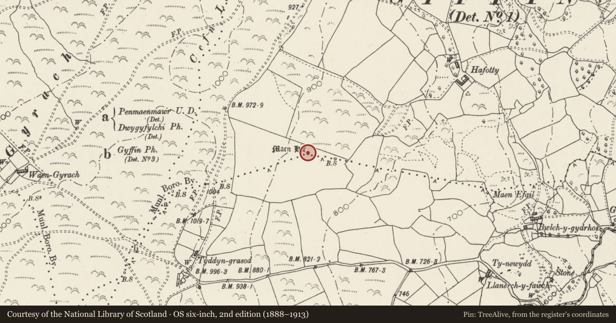
Slide toward Today to fade the historical sheet and see the modern map underneath.
David Rumsey Map Collection, Stanford LibrariesDavid Rumsey Map Collection, Stanford LibrariesDavid Rumsey Map Collection, Stanford LibrariesDavid Rumsey Map Collection, Stanford LibrariesLlyfrgell Genedlaethol Cymru – The National Library of Wales
5 historical maps cover this location, the earliest the 1795 map "To Sir Watkin Williams-Wynn Bart ... the map of the six counties of North Wales is most humbly inscribed by his obedient humble servant" (Llyfrgell Genedlaethol Cymru – The National Library of Wales).
Historical maps covering this location
- 1795 · To Sir Watkin Williams-Wynn Bart ... the map of the six counties of North Wales is most… (Llyfrgell Genedlaethol Cymru – The National Library of Wales)
- 1883 · Watershed map England, Wales 3. (David Rumsey Map Collection, Stanford Libraries)
- 1896 · Sheet 7. Ordnance Survey of England and Wales. (David Rumsey Map Collection, Stanford Libraries)
- 1899 · 106 Bangor (Outline) (David Rumsey Map Collection, Stanford Libraries)
- 1901 · Sheet 9 and 10. (David Rumsey Map Collection, Stanford Libraries)
Cadw's description
Summary description and reason for designation
The scheduled monument comprises the remains of a standing stone, which probably dates to the Bronze Age (c. 2300 - 800 BC). It measures 2.25m high and nearly 0.8m square.
The monument is of national importance for its potential to enhance our knowledge of prehistoric burial and ritual practices. It is an important relic of a prehistoric funerary and ritual landscape and retains significant archaeological potential. There is a strong probability of the presence of intact burial or ritual deposits, together with environmental and structural evidence. Standing stones are often part of a larger cluster of monuments and their importance can further enhanced by their group value.
The scheduled area comprises the remains described and areas around them within which related evidence may be expected to survive.
Nearby in the register
- Cefn Llechen Stone CircleStone Circleunder 1 mi
- Cefn Llechen cairnsRound Cairnunder 1 mi
- Ring Cairn North-West of Llyn y WrachRing Cairnunder 1 mi
- Hut Groups N of Cerrig y DinasEnclosed hut circleunder 1 mi
Other entries of the same register within about three miles of this one, by straight line.