Cof Cymru: National Historic Assets of Wales · Wales
Pennarth Fawr
Llanystumdwy, Gwynedd, Wales
A scheduled monument in Llanystumdwy, Gwynedd, recorded as House (domestic) (Medieval).
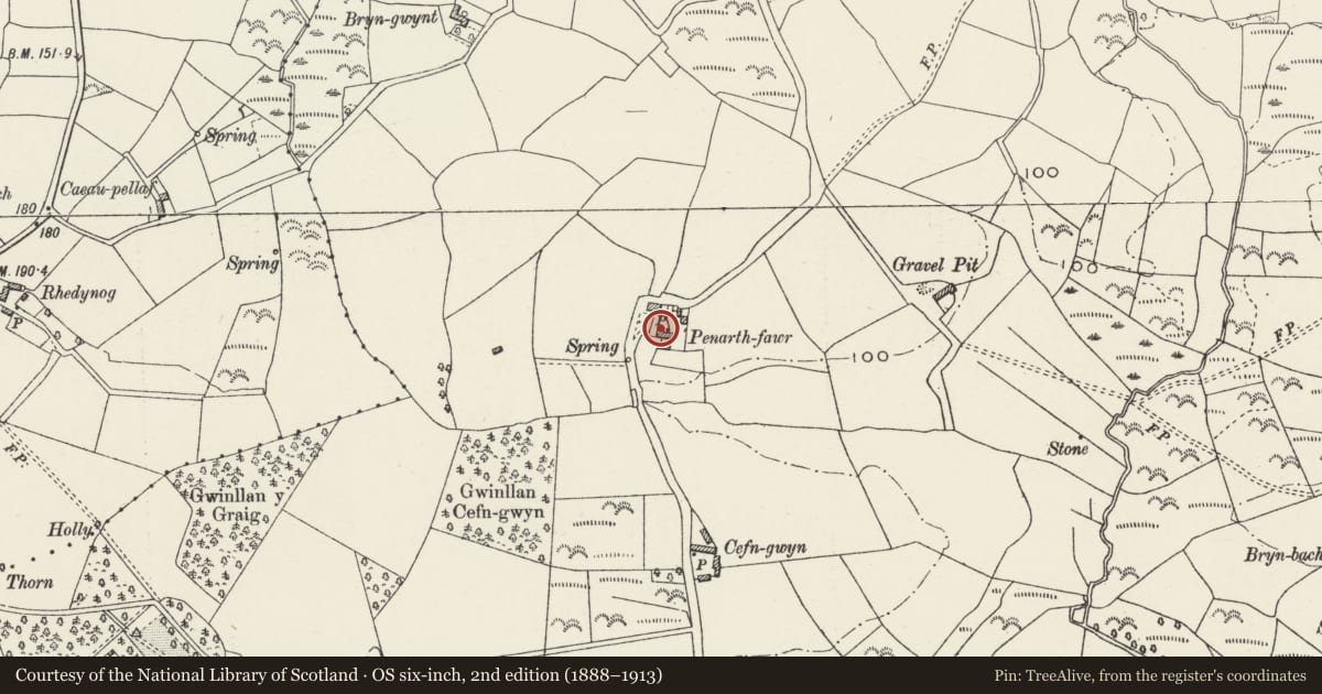
The record
- Designation
- Scheduled monument
- Site type
- House (domestic)
- Period
- Medieval
- Community
- Llanystumdwy
- Unitary authority
- Gwynedd
- Country
- Wales
- Coordinates (centre of the scheduled area)
- 52.91321, -4.35237
- SAM number
- CN086
- Cadw record number
- 3172
Slide toward Today to fade the historical sheet and see the modern map underneath.
David Rumsey Map Collection, Stanford LibrariesDavid Rumsey Map Collection, Stanford LibrariesDavid Rumsey Map Collection, Stanford LibrariesDavid Rumsey Map Collection, Stanford LibrariesLlyfrgell Genedlaethol Cymru – The National Library of Wales
5 historical maps cover this location, the earliest the 1795 map "To Sir Watkin Williams-Wynn Bart ... the map of the six counties of North Wales is most humbly inscribed by his obedient humble servant" (Llyfrgell Genedlaethol Cymru – The National Library of Wales).
Historical maps covering this location
- 1795 · To Sir Watkin Williams-Wynn Bart ... the map of the six counties of North Wales is most… (Llyfrgell Genedlaethol Cymru – The National Library of Wales)
- 1883 · Watershed map England, Wales 3. (David Rumsey Map Collection, Stanford Libraries)
- 1896 · Sheet 7. Ordnance Survey of England and Wales. (David Rumsey Map Collection, Stanford Libraries)
- 1899 · 118 Nevin (Hills) (David Rumsey Map Collection, Stanford Libraries)
- 1901 · Sheet 9 and 10. (David Rumsey Map Collection, Stanford Libraries)
Cadw's description
Summary description and reason for designation
The following provides a general description of the Scheduled Monument.
Penarth Fawr is a medieval manor house, a fine example of a 15th century home of a Welsh gentry family.
A 15th century aisle-truss hall, with 17th and 18th century additions. The remains consist of a two-bay hall, a cross passage, and service rooms beyond. The building is aligned N-S with the service rooms at the S end. More rooms (presumably the solar) were attached to the N end of the hall, but were removed in the 19th century. The hall is divided from the cross-passage by a fine spere-truss. A lateral fireplace was inserted into the E wall during the 17th century. The area S of the cross-passage has had an upper floor inserted, and there is a cellar underneath. The E door is blocked, and access is gained into the building through the W door, which has a simple arched head of stone voussoirs.
The monument is of national importance for its potential to enhance our knowledge of medieval building. It retains significant archaeological potential, with a strong probability of the presence of associated archaeological features and deposits. The structures themselves may be expected to contain archaeological information concerning chronology and building techniques.
The scheduled area comprises the remains described and areas around them within which related evidence may be expected to survive.
Nearby in the register
- Penarth-fawrDomesticunder 1 mi
- House at Penarth-fawrDomesticunder 1 mi
- Former Stable at Penarth-fawrAgriculture and Subsistenceunder 1 mi
- Ysgubor DegwmDomesticunder 1 mi
Other entries of the same register within about three miles of this one, by straight line.