Cof Cymru: National Historic Assets of Wales · Wales
Early Christian Inscribed Stone in the Churchyard, Llanaelhaearn
Llanaelhaearn, Gwynedd, Wales
A scheduled monument in Llanaelhaearn, Gwynedd, recorded as Inscribed Stone (Early Medieval).
The record
- Designation
- Scheduled monument
- Site type
- Inscribed Stone
- Period
- Early Medieval
- Date of designation
- 10 May 1947
- Community
- Llanaelhaearn
- Unitary authority
- Gwynedd
- Country
- Wales
- Coordinates (centre of the scheduled area)
- 52.97639, -4.40405
- SAM number
- CN084
- Cadw record number
- 3170
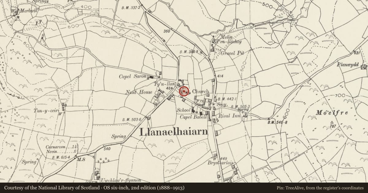
Slide toward Today to fade the historical sheet and see the modern map underneath.
David Rumsey Map Collection, Stanford LibrariesDavid Rumsey Map Collection, Stanford LibrariesDavid Rumsey Map Collection, Stanford LibrariesDavid Rumsey Map Collection, Stanford LibrariesLlyfrgell Genedlaethol Cymru – The National Library of Wales
5 historical maps cover this location, the earliest the 1795 map "To Sir Watkin Williams-Wynn Bart ... the map of the six counties of North Wales is most humbly inscribed by his obedient humble servant" (Llyfrgell Genedlaethol Cymru – The National Library of Wales).
Historical maps covering this location
- 1795 · To Sir Watkin Williams-Wynn Bart ... the map of the six counties of North Wales is most… (Llyfrgell Genedlaethol Cymru – The National Library of Wales)
- 1883 · Watershed map England, Wales 3. (David Rumsey Map Collection, Stanford Libraries)
- 1896 · Sheet 7. Ordnance Survey of England and Wales. (David Rumsey Map Collection, Stanford Libraries)
- 1899 · 118 Nevin (Hills) (David Rumsey Map Collection, Stanford Libraries)
- 1901 · Sheet 9 and 10. (David Rumsey Map Collection, Stanford Libraries)
Cadw's description
Summary description and reason for designation
The following provides a general description of the Scheduled Monument.
A small upright granite stone (0.95m tall) with an early Christian inscription. It was dug up in the churchyard in 1923 and now stands (base uppermost) on the S side of the path leading to the W door of the church. On one face is an inscription consisting of six letters MELITV in one line reading vertically. A mark following the V is due to attempts made to 'complete' the inscription since its discovery. The inscription probably dates to the 5th or early 6th century.
The monument is of national importance for its potential to enhance our knowledge of the early medieval period and Christianity in Wales.
The scheduled area comprises the remains described and areas around them within which related evidence may be expected to survive.
Nearby in the register
- Part of Inscribed Stone Built into Wall of ChurchyardInscribed Stoneunder 1 mi
- Church of St AelhaearnReligious, Ritual and Funeraryunder 1 mi
- Telephone Call-boxCommunicationsunder 1 mi
- Tre'r Ceiri CampHillfortunder 1 mi
Other entries of the same register within about three miles of this one, by straight line.