Cof Cymru: National Historic Assets of Wales · Wales
Llangan Church Cropmark Enclosure
Henllanfallteg, Carmarthenshire, Wales
A scheduled monument in Henllanfallteg, Carmarthenshire, recorded as Enclosure (Prehistoric).
The record
- Designation
- Scheduled monument
- Site type
- Enclosure
- Period
- Prehistoric
- Date of designation
- 2 March 1994
- Community
- Henllanfallteg
- Unitary authority
- Carmarthenshire
- Country
- Wales
- Coordinates (centre of the scheduled area)
- 51.83729, -4.64699
- SAM number
- CM264
- Cadw record number
- 2180
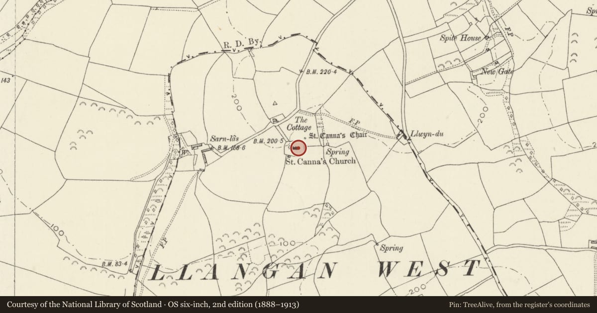
Slide toward Today to fade the historical sheet and see the modern map underneath.
David Rumsey Map Collection, Stanford LibrariesDavid Rumsey Map Collection, Stanford LibrariesDavid Rumsey Map Collection, Stanford LibrariesDavid Rumsey Map Collection, Stanford LibrariesDavid Rumsey Map Collection, Stanford Libraries
5 historical maps cover this location, the earliest the 1636 map "Cornubia : Devonia, Somersetus, Dorcestria, Wiltonia, Glocestria ..." (David Rumsey Map Collection, Stanford Libraries).
Historical maps covering this location
- 1636 · Cornubia : Devonia, Somersetus, Dorcestria, Wiltonia, Glocestria ... (David Rumsey Map Collection, Stanford Libraries)
- 1830 · V.3:11-15:XV. Britisches Reich. A. Kon: England. b. Frstenthum Wales: Shire: 37-40 (David Rumsey Map Collection, Stanford Libraries)
- 1891 · Sheet 10. Ordnance Survey of England and Wales. . (David Rumsey Map Collection, Stanford Libraries)
- 1898 · 228 Haverfordwest (Hills) (David Rumsey Map Collection, Stanford Libraries)
- 1901 · Sheet 13. (David Rumsey Map Collection, Stanford Libraries)
Cadw's description
Summary description and reason for designation
The following provides a general description of the Scheduled Ancient Monument.
The monument comprises the remains of an earthwork/stone-built enclosure. The date or precise nature of the enclosure is unknown, but it is likely to be later prehistoric. The inner enclosure measures c. 17m in diameter and the outer oval enclosure c. 95m by 15m. A linear cropmark gives the southern boundary to monument and slight earthworks in northern half of OS field No 7563 may correspond to cropmark features.
The monument is of national importance for its potential to enhance our knowledge of later prehistoric defensive organisation and settlement. The site forms an important element within the wider later prehistoric context and within the surrounding landscape. The site is well preserved and retains considerable archaeological potential. There is a strong probability of the presence of evidence relating to chronology, building techniques and functional detail.
The scheduled area comprises the remains described and areas around them within which related evidence may be expected to survive.
Nearby in the register
- St Canna's ChairInscribed Stoneunder 1 mi
- Trewern MansionDomesticunder 1 mi
- Inscribed Stone N of Parciau FarmhouseInscribed Stoneunder 1 mi
- 2 Clun CottagesDomesticunder 1 mi
Other entries of the same register within about three miles of this one, by straight line.