Cof Cymru: National Historic Assets of Wales · Wales
Roman Amphitheatre
Carmarthen, Carmarthenshire, Wales
A scheduled monument in Carmarthen, Carmarthenshire, recorded as Amphitheatre (Roman).
The record
- Designation
- Scheduled monument
- Site type
- Amphitheatre
- Period
- Roman
- Date of designation
- 1 November 1968
- Community
- Carmarthen
- Unitary authority
- Carmarthenshire
- Country
- Wales
- Coordinates (centre of the scheduled area)
- 51.86212, -4.29649
- SAM number
- CM206
- Cadw record number
- 2813
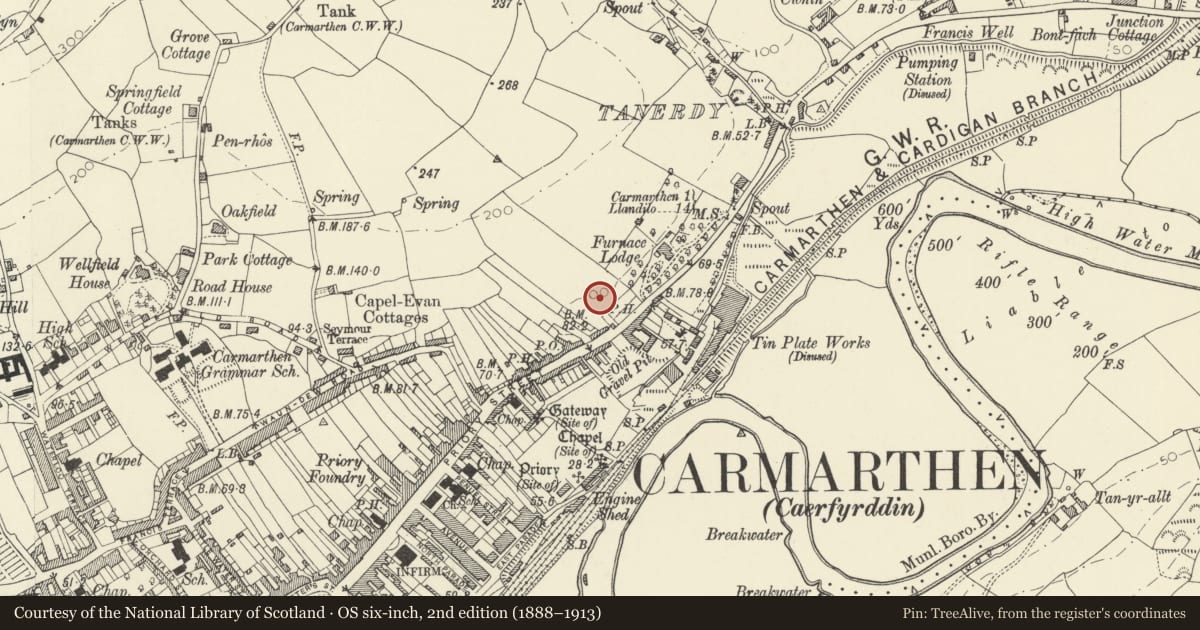
Slide toward Today to fade the historical sheet and see the modern map underneath.
David Rumsey Map Collection, Stanford LibrariesDavid Rumsey Map Collection, Stanford LibrariesDavid Rumsey Map Collection, Stanford LibrariesDavid Rumsey Map Collection, Stanford LibrariesDavid Rumsey Map Collection, Stanford Libraries
5 historical maps cover this location, the earliest the 1636 map "Cornubia : Devonia, Somersetus, Dorcestria, Wiltonia, Glocestria ..." (David Rumsey Map Collection, Stanford Libraries).
Historical maps covering this location
- 1636 · Cornubia : Devonia, Somersetus, Dorcestria, Wiltonia, Glocestria ... (David Rumsey Map Collection, Stanford Libraries)
- 1860 · 41. Caermathen. (David Rumsey Map Collection, Stanford Libraries)
- 1891 · Sheet 10. Ordnance Survey of England and Wales. . (David Rumsey Map Collection, Stanford Libraries)
- 1898 · 229 Carmarthen (Hills) (David Rumsey Map Collection, Stanford Libraries)
- 1901 · Sheet 14. (David Rumsey Map Collection, Stanford Libraries)
Cadw's description
Summary description and reason for designation
The following provides a general description of the Scheduled Ancient Monument.
The monument consists of the remains of an amphitheatre, believed to date primarily to the 2nd century AD within Roman period (1st - 4th century AD) and which is located c 250m to the north east of the boundary of town defences of Roman Carmarthen (Moridunum). The amphitheatre has an elliptical structure, with a long axis of c 90m and a short axis of c 60m. It was excavated in 1968 and 1970, revealing the course of the arena wall and traces of the seating arrangement, giving an estimated seating capacity of 4500-5000. It was constructed by cutting into the hillside to the north and using the excavated soil to make up the south bank of the seating area (cavea).
The monument is of national importance for its potential to enhance our knowledge of Roman military and urban organisation. It retains significant archaeological potential, with a strong probability of the presence of associated archaeological features and deposits. The structure itself may be expected to contain archaeological information concerning chronology and building techniques, together with a strong probability of environmental evidence. Amphitheatres may be part of a larger cluster of monuments and their importance can further enhanced by their group value.
The scheduled area comprises the remains described and areas around them within which related evidence may be expected to survive.
Nearby in the register
- Entrance gates to Y Garreg FilltirDomesticunder 1 mi
- Y Garreg Filltir with rear low wall and railingDomesticunder 1 mi
- Former Blast Furnace and attached buildingIndustrialunder 1 mi
- St John's Priory Precinct Wall or Nun's WalkReligious, Ritual and Funeraryunder 1 mi
Other entries of the same register within about three miles of this one, by straight line.