Cof Cymru: National Historic Assets of Wales · Wales
Clawdd-Mawr
Cynwyl Elfed, Carmarthenshire, Wales
A scheduled monument in Cynwyl Elfed, Carmarthenshire, recorded as Linear Earthwork (Early Medieval).
The record
- Designation
- Scheduled monument
- Site type
- Linear Earthwork
- Period
- Early Medieval
- Date of designation
- 5 July 1951
- Community
- Cynwyl Elfed
- Unitary authority
- Carmarthenshire
- Country
- Wales
- Coordinates (centre of the scheduled area)
- 51.97522, -4.36434
- SAM number
- CM110
- Cadw record number
- 2123
Slide toward Today to fade the historical sheet and see the modern map underneath.
David Rumsey Map Collection, Stanford LibrariesDavid Rumsey Map Collection, Stanford LibrariesDavid Rumsey Map Collection, Stanford LibrariesDavid Rumsey Map Collection, Stanford LibrariesDavid Rumsey Map Collection, Stanford Libraries
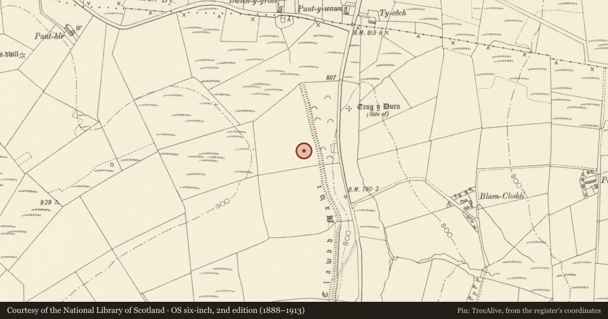
5 historical maps cover this location, the earliest the 1636 map "Cornubia : Devonia, Somersetus, Dorcestria, Wiltonia, Glocestria ..." (David Rumsey Map Collection, Stanford Libraries).
Historical maps covering this location
- 1636 · Cornubia : Devonia, Somersetus, Dorcestria, Wiltonia, Glocestria ... (David Rumsey Map Collection, Stanford Libraries)
- 1860 · 41. Caermathen. (David Rumsey Map Collection, Stanford Libraries)
- 1891 · Sheet 10. Ordnance Survey of England and Wales. . (David Rumsey Map Collection, Stanford Libraries)
- 1898 · 211 Newcastle Emlyn (Hills) (David Rumsey Map Collection, Stanford Libraries)
- 1901 · Sheet 14. (David Rumsey Map Collection, Stanford Libraries)
Cadw's description
Summary description and reason for designation
The following provides a general description of the Scheduled Ancient Monument.
Linear earthwork consisting of a well preserved bank and a ditch on the E (downhill) side. The earthwork runs form just N of the farmhouse, roughly N/S through four fields along the E margin of these fields, whence the ground falls sharply toward the road. The hedges of the fields are outside the ditch, and the earthwork is generally very well preserved. Its N end is at a boggy area. On its S end, it appears to have a ditch both on the W and E side. For details of the measurements, see sketches, but generally, the bank is 1-1.8m high on the uphill side, 2-4m high from the bottom of the E ditch which is itself up to 1.6m deep. The earthwork is c. 16m across. It has various cuts through, erosion scars etc, as the fields around it are used for cattle pasture. The earthwork has never been ploughed.
Nearby in the register
- Panthir Defended EnclosureEnclosure - Defensiveunder 1 mi
- Cerrig Llwydion Burial ChamberChambered Tombunder 1 mi
- Crug TarwRound Barrowunder 1 mi
- Crug Glas Round BarrowRound Barrowunder 1 mi
Other entries of the same register within about three miles of this one, by straight line.