Cof Cymru: National Historic Assets of Wales · Wales
Pemprys Rural Settlement
Ysgubor-y-Coed, Ceredigion, Wales
A scheduled monument in Ysgubor-y-Coed, Ceredigion, recorded as Rectangular hut (Post Medieval/Modern).
The record
- Designation
- Scheduled monument
- Site type
- Rectangular hut
- Period
- Post Medieval/Modern
- Date of designation
- 1 June 2000
- Community
- Ysgubor-y-Coed
- Unitary authority
- Ceredigion
- Country
- Wales
- Coordinates (centre of the scheduled area)
- 52.52998, -3.88066
- SAM number
- CD198
- Cadw record number
- 1652
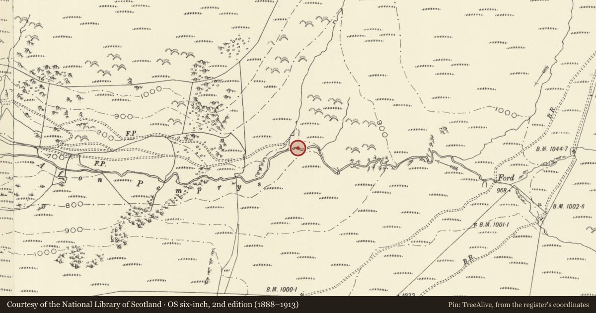
Slide toward Today to fade the historical sheet and see the modern map underneath.
David Rumsey Map Collection, Stanford LibrariesDavid Rumsey Map Collection, Stanford LibrariesBayerische Staatsbibliothek, MunichDavid Rumsey Map Collection, Stanford LibrariesDavid Rumsey Map Collection, Stanford Libraries
5 historical maps cover this location, the earliest the 1588 map "Ortelius, Abraham: Theatro De La Tierra Universal. 0" (Bayerische Staatsbibliothek, Munich).
Historical maps covering this location
- 1588 · Ortelius, Abraham: Theatro De La Tierra Universal. 0 (Bayerische Staatsbibliothek, Munich)
- 1608 · (13) Cambriae Typus. (David Rumsey Map Collection, Stanford Libraries)
- 1896 · Sheet 7. Ordnance Survey of England and Wales. (David Rumsey Map Collection, Stanford Libraries)
- 1899 · 163 Aberystwyth (Hills) (David Rumsey Map Collection, Stanford Libraries)
- 1901 · Sheet 14. (David Rumsey Map Collection, Stanford Libraries)
Cadw's description
Summary description and reason for designation
The following provides a general description of the Scheduled Monument.
The monument comprises a long hut, which probably dates to the prehistoric/Medieval period, lying just north of the Afon Pemprys at a natural junction of its tributaries. The building measures 12 x 6m in size and is defined by low earth and stone banks. It is likely that these formed the wall bases for a superstructure built from earth or timber. The building appears to be a well preserved and undisturbed example of an early upland hafod. Added interest is given to the site by its proximity to an earth cut hollow which leads into the river, probably used for dipping sheep.
The monument is of national importance for its potential to enhance our knowledge of prehistoric/medieval settlement. The monument forms an important element within the wider prehistoric/medieval context. The scheduled area may be expected to contain a wide range of archaeological information, including preserved internal features, floor levels and deposits as well as evidence in regard to chronological detail, construction techniques and agricultural methods. Rectangular huts may be part of a larger cluster of settlements and their importance can be further enhanced by their group value.
The scheduled area comprises the remains described and areas around them within which related evidence may be expected to survive.
Nearby in the register
- PemprysDomesticunder 1 mi
- Ystrad Einion Lead Mine Buildings and Water WheelLead Mine1 mi
- DynynDomestic1 mi
- Cerrig Blaencletwr-Fawr Round CairnRound Cairn1 mi
Other entries of the same register within about three miles of this one, by straight line.