Cof Cymru: National Historic Assets of Wales · Wales
Beaumaris Town Wall
Beaumaris, Isle of Anglesey, Wales
A scheduled monument in Beaumaris, Isle of Anglesey, recorded as Town Wall (Medieval).
The record
- Designation
- Scheduled monument
- Site type
- Town Wall
- Period
- Medieval
- Date of designation
- 20 June 1979
- Community
- Beaumaris
- Unitary authority
- Isle of Anglesey
- Country
- Wales
- Coordinates (centre of the scheduled area)
- 53.26465, -4.09416
- SAM number
- AN123
- Cadw record number
- 2548
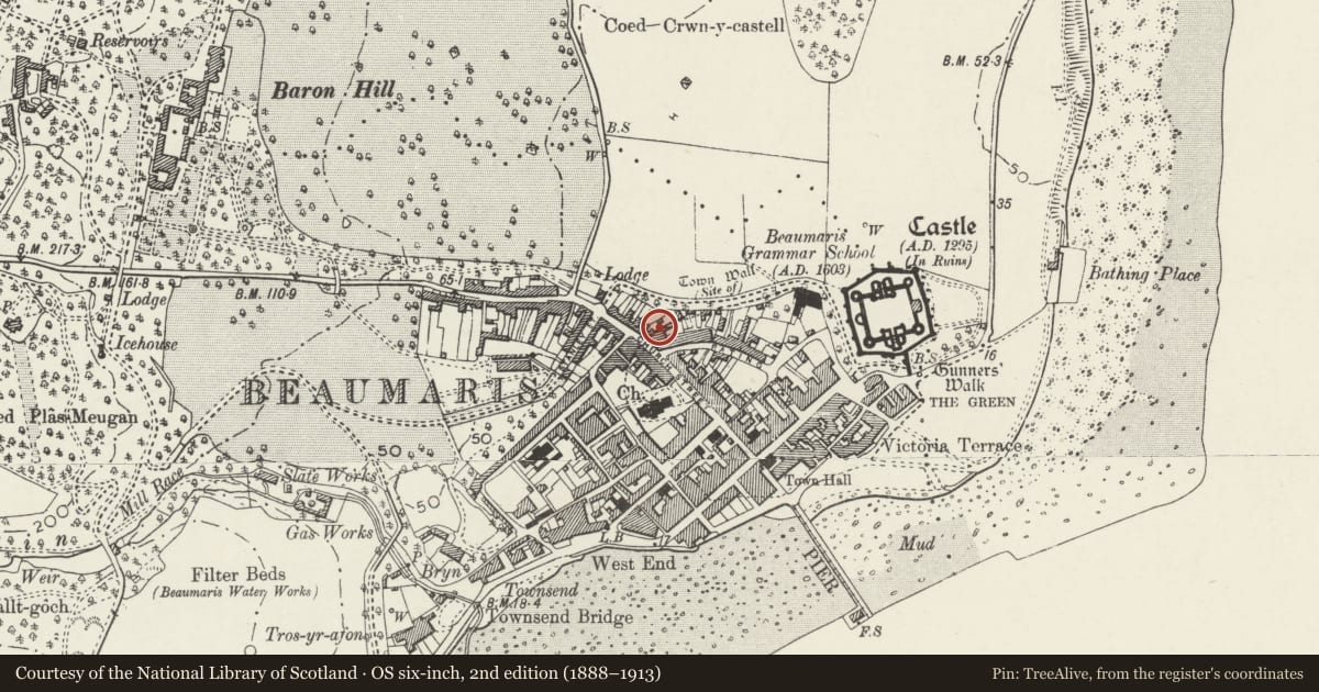
Slide toward Today to fade the historical sheet and see the modern map underneath.
David Rumsey Map Collection, Stanford LibrariesDavid Rumsey Map Collection, Stanford LibrariesDavid Rumsey Map Collection, Stanford LibrariesDavid Rumsey Map Collection, Stanford LibrariesDavid Rumsey Map Collection, Stanford Libraries
5 historical maps cover this location, the earliest the 1883 map "Watershed map England, Wales 3." (David Rumsey Map Collection, Stanford Libraries).
Historical maps covering this location
- 1883 · Watershed map England, Wales 3. (David Rumsey Map Collection, Stanford Libraries)
- 1896 · Sheet 7. Ordnance Survey of England and Wales. (David Rumsey Map Collection, Stanford Libraries)
- 1899 · 94 Beaumaris (Hills) (David Rumsey Map Collection, Stanford Libraries)
- 1901 · Sheet 9 and 10. (David Rumsey Map Collection, Stanford Libraries)
- 1919 · Sheet 41. Anglesey. (David Rumsey Map Collection, Stanford Libraries)
Cadw's description
Summary description and reason for designation
The following provides a general description of the Scheduled Ancient Monument.
The only surviving section of Beaumaris town wall suitable for scheduling. About 20 m long, 3 m high and 1.75 m wide. Part of the outer face is missing. A Grade I listed building (ref. 3/40).
The monument is of national importance for its potential to enhance our knowledge of medieval structures and town alignments and defence. It retains significant archaeological potential, with a strong probability of the presence of associated archaeological features and deposits. The structures themselves may be expected to contain archaeological information concerning chronology and building techniques.
The scheduled area comprises the remains described and areas around them within which related evidence may be expected to survive.
Nearby in the register
- Remains of Medieval Town WallDefenceunder 1 mi
- Victoria HouseDomesticunder 1 mi
- Sailors' Return Public HouseCommercialunder 1 mi
- 42 Rating RowDomesticunder 1 mi
Other entries of the same register within about three miles of this one, by straight line.