Cof Cymru: National Historic Assets of Wales · Wales
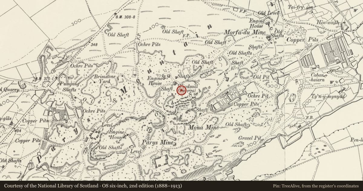
Parys Mountain: Windmill, Engine House, Precipitation Pits and Great Opencast
Amlwch, Isle of Anglesey, Wales
A scheduled monument in Amlwch, Isle of Anglesey, recorded as Tower (Post Medieval/Modern).
The record
- Designation
- Scheduled monument
- Site type
- Tower
- Period
- Post Medieval/Modern
- Date of designation
- 7 October 1991
- Community
- Amlwch
- Unitary authority
- Isle of Anglesey
- Country
- Wales
- Coordinates (centre of the scheduled area)
- 53.38815, -4.34206
- SAM number
- AN111
- Cadw record number
- 252
Slide toward Today to fade the historical sheet and see the modern map underneath.
David Rumsey Map Collection, Stanford LibrariesDavid Rumsey Map Collection, Stanford LibrariesDavid Rumsey Map Collection, Stanford LibrariesDavid Rumsey Map Collection, Stanford LibrariesDavid Rumsey Map Collection, Stanford Libraries
5 historical maps cover this location, the earliest the 1608 map "(13) Cambriae Typus." (David Rumsey Map Collection, Stanford Libraries).
Historical maps covering this location
- 1608 · (13) Cambriae Typus. (David Rumsey Map Collection, Stanford Libraries)
- 1896 · Sheet 7. Ordnance Survey of England and Wales. (David Rumsey Map Collection, Stanford Libraries)
- 1899 · 93 Holyhead (Hills) (David Rumsey Map Collection, Stanford Libraries)
- 1901 · Sheet 9 and 10. (David Rumsey Map Collection, Stanford Libraries)
- 1919 · Sheet 41. Anglesey. (David Rumsey Map Collection, Stanford Libraries)
Cadw's description
Summary description and reason for designation
The following provides a general description of the Scheduled Ancient Monument.
4 elements - Windmill tower (A), engine house (B), precipitation pits (C) and Great Opencast (D).
Work began on Parys Mountain copper mine about 1765, though there are traces of prehistoric and Roman mining. Opencast mining ceased about 1800, though underground work continued until about 1880. The precipitation pits, engine house and windmill (which assisted a nearby steam engine in pumping a mine work) are probably nineteenth century in date.
The monument is of national importance for its potential to enhance our knowledge the mining industry. It retains significant archaeological potential, with a strong probability of the presence of associated archaeological features and deposits. The structures themselves may be expected to contain archaeological information concerning chronology and building techniques.
The scheduled area comprises the remains described and areas around them within which related evidence may be expected to survive.
Nearby in the register
- Parys Mountain WindmillIndustrialunder 1 mi
- Mona Mine Kilns and Sublimation Chambers, Mynydd ParysCopper Mineunder 1 mi
- Pearl Engine HouseIndustrialunder 1 mi
- Dyffryn Adda Copper Furnace and Precipitation PondsCopper Mineunder 1 mi
Other entries of the same register within about three miles of this one, by straight line.