Cof Cymru: National Historic Assets of Wales · Wales
Hut Group N of Glan'r Afon
Moelfre, Isle of Anglesey, Wales
A scheduled monument in Moelfre, Isle of Anglesey, recorded as Unenclosed hut circle (Prehistoric).
The record
- Designation
- Scheduled monument
- Site type
- Unenclosed hut circle
- Period
- Prehistoric
- Community
- Moelfre
- Unitary authority
- Isle of Anglesey
- Country
- Wales
- Coordinates (centre of the scheduled area)
- 53.34479, -4.25347
- SAM number
- AN095
- Cadw record number
- 185
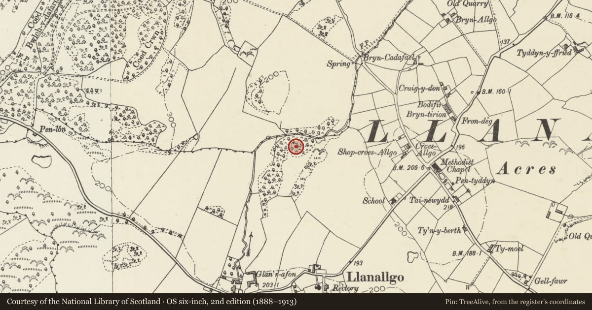
Slide toward Today to fade the historical sheet and see the modern map underneath.
David Rumsey Map Collection, Stanford LibrariesDavid Rumsey Map Collection, Stanford LibrariesDavid Rumsey Map Collection, Stanford LibrariesDavid Rumsey Map Collection, Stanford LibrariesDavid Rumsey Map Collection, Stanford Libraries
5 historical maps cover this location, the earliest the 1883 map "Watershed map England, Wales 3." (David Rumsey Map Collection, Stanford Libraries).
Historical maps covering this location
- 1883 · Watershed map England, Wales 3. (David Rumsey Map Collection, Stanford Libraries)
- 1896 · Sheet 7. Ordnance Survey of England and Wales. (David Rumsey Map Collection, Stanford Libraries)
- 1899 · 93 Holyhead (Hills) (David Rumsey Map Collection, Stanford Libraries)
- 1901 · Sheet 9 and 10. (David Rumsey Map Collection, Stanford Libraries)
- 1919 · Sheet 41. Anglesey. (David Rumsey Map Collection, Stanford Libraries)
Cadw's description
Summary description and reason for designation
The following provides a general description of the Scheduled Monument.
The monument comprises the remains of a complex of structures that probably date to the Iron Age or Romano-British period (c. 800 BC - AD 400), including at least one well preserved hut-circle and two sections of linear walling. The internal diameter of the hut circle is between 7.5 and 8.0 m, with a rubble-filled double wall 1.2 m thick, of upright limestone slabs up to 0.8 m high. The 2.0 m wide entrance is on the NE. A large ash tree is growing inside the hut on the N side.
The monument is of national importance for its potential to enhance our knowledge of later prehistoric domestic construction practices. The monument retains significant archaeological potential and there is a strong probability that structural evidence has survived, together with internal and external floor surfaces.
The scheduled area comprises the remains described and areas around them within which related evidence may be expected to survive.
Nearby in the register
- Tyn-y-llan including attached outbuilding rangeDomesticunder 1 mi
- Church of St AllgoReligious, Ritual and Funeraryunder 1 mi
- Royal Charter MemorialCommemorativeunder 1 mi
- Llugwy Chambered TombChambered Tombunder 1 mi
Other entries of the same register within about three miles of this one, by straight line.