Cof Cymru: National Historic Assets of Wales · Wales
Bryn Seion Chapel
Broughton, Wrexham, Wales
A Grade II listed building in Broughton, Wrexham, designated on 3 June 1964.
The record
- Designation
- Listed building, Grade II
- Broad class
- Religious, Ritual and Funerary
- Date of designation
- 3 June 1964
- Community
- Broughton
- Unitary authority
- Wrexham
- Country
- Wales
- Coordinates
- 53.07729, -3.04853
- Cadw reference
- 9813
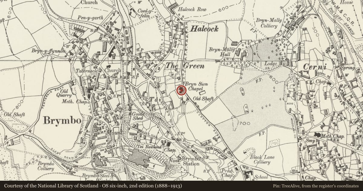
Slide toward Today to fade the historical sheet and see the modern map underneath.
David Rumsey Map Collection, Stanford LibrariesDavid Rumsey Map Collection, Stanford LibrariesDavid Rumsey Map Collection, Stanford LibrariesLlyfrgell Genedlaethol Cymru – The National Library of WalesDavid Rumsey Map Collection, Stanford Libraries
5 historical maps cover this location, the earliest the 1608 map "(13) Cambriae Typus." (David Rumsey Map Collection, Stanford Libraries).
Historical maps covering this location
- 1608 · (13) Cambriae Typus. (David Rumsey Map Collection, Stanford Libraries)
- 1795 · To Sir Watkin Williams-Wynn Bart ... the map of the six counties of North Wales is most… (Llyfrgell Genedlaethol Cymru – The National Library of Wales)
- 1883 · Watershed map England, Wales 3. (David Rumsey Map Collection, Stanford Libraries)
- 1898 · 121 Wrexham (Hills) (David Rumsey Map Collection, Stanford Libraries)
- 1901 · Sheet 9 and 10. (David Rumsey Map Collection, Stanford Libraries)
Cadw's description
Location
Alongside the road and prominently sited above the deep valley which forms the boundary between Broughton and Brymbo.
History
Built as a Welsh Congregational Church, an inscribed stone over the entrance records (in Welsh) that the chapel was built in 1840 and rebuilt in 1860. The original chapel had been established in a converted dwelling house in 1802, but a new chapel was built in 1840; a successor built in 1851 collapsed and was replaced in 1860. It closed as a chapel in 1968.
Exterior
Coursed and squared stone and ashlar to entrance front, with slate roof with tiled cresting. Entrance in S-facing gable, and 6-window range facing street, articulated by pilaster buttresses which have moulded capitals and plain imposts forming hood moulds to round-headed windows. These are divided as 2-round-headed lights, with timber columnar mullions. The coped gable pediments the S-facing gable, which has paired doorways, each of which is flanked by 8-pane windows. All the openings have pedimented heads, but the doorways have full architraves, with Tuscan pilasters on high bases.
Reason for designation
A very good example of a Neo-classical chapel, which, on its hilltop site, is a prominent feature of the area.
Nearby in the register
- Brymbo Ironworks: Early Blast Furnace, Cast House & FoundryIronworksunder 1 mi
- Former Agent's House at site of Brymbo IronworksDomesticunder 1 mi
- Church of Saint MaryReligious, Ritual and Funeraryunder 1 mi
- Offa's Dyke: Brymbo Hill SectionLinear Earthworkunder 1 mi
Other entries of the same register within about three miles of this one, by straight line.