Cof Cymru: National Historic Assets of Wales · Wales
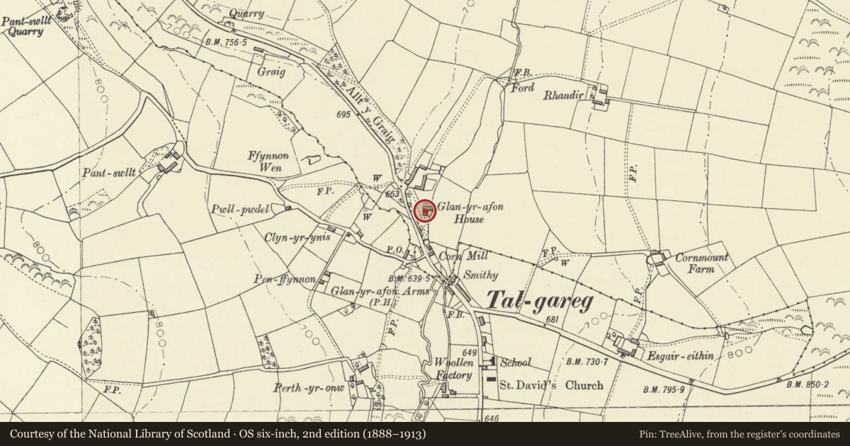
Plas (formerly in Llanarth Parish)
Llandysiliogogo, Ceredigion, Wales
A Grade II listed building in Talgarreg, Llandysiliogogo, Ceredigion, designated on 3 June 1964.
The record
- Designation
- Listed building, Grade II
- Broad class
- Domestic
- Date of designation
- 3 June 1964
- Locality
- Talgarreg
- Community
- Llandysiliogogo
- Unitary authority
- Ceredigion
- Country
- Wales
- Coordinates
- 52.13766, -4.30276
- Cadw reference
- 9799
Slide toward Today to fade the historical sheet and see the modern map underneath.
David Rumsey Map Collection, Stanford LibrariesDavid Rumsey Map Collection, Stanford LibrariesDavid Rumsey Map Collection, Stanford LibrariesDavid Rumsey Map Collection, Stanford LibrariesDavid Rumsey Map Collection, Stanford Libraries
5 historical maps cover this location, the earliest the 1608 map "(13) Cambriae Typus." (David Rumsey Map Collection, Stanford Libraries).
Historical maps covering this location
- 1608 · (13) Cambriae Typus. (David Rumsey Map Collection, Stanford Libraries)
- 1830 · V.3:11-15:XV. Britisches Reich. A. Kon: England. b. Frstenthum Wales: Shire: 37-40 (David Rumsey Map Collection, Stanford Libraries)
- 1899 · 194 Llangranog (Hills) (David Rumsey Map Collection, Stanford Libraries)
- 1901 · Sheet 14. (David Rumsey Map Collection, Stanford Libraries)
- 1919 · Sheet 78. Lampeter. (David Rumsey Map Collection, Stanford Libraries)
Cadw's description
Location
Situated towards N end of Talgarreg on E side of by-road alongside short driveway.
History
Built c1825. Seat of the Lloyd-Williams family until early C20. Some late C19/early C20 remodelling to facade.
Exterior
Roughcast facade with late C19/early C20 smooth stuccoed quoins and upper sill-band: also stuccoed lugged and shouldered surrounds to windows and door (raised keystones to ground floor openings and first floor centre window). Hipped slate roof, wide bracketted eaves. Rendered end chimney stacks. Two storey 3-bay front with original 12-pane hornless sash window to first floor centre: the other windows have similar glazing, but were much elongated in the late C19/earlyC20. Slate sills. C20 door to centre with plain overlight.
Wing to left side remodelled and lowered to form 2-bay lean-to. Blank right end. Rear with lower gabled stairwell to centre having upper 3/6 hornless sash window and small 4-pane casement to ground floor of left return wall. Twelve-pane hornless sash window to first floor right and left; also to ground floor right. C20 glazed door to left.
Interior
Some modernisation, but retains dog-leg stick baluster staircase. Six-panel doors to ground floor. Cellar
Reason for designation
Early C19 small country house which has retained its character.
Nearby in the register
- South Gate-piers and Gates at Plas (formerly in Llanarth Parish)Domesticunder 1 mi
- Crug Cou Round BarrowRound Barrow1 mi
- Whilgarn Ring CairnRing Cairn1 mi
- Blaen Glowen Round BarrowRound Barrow2 mi
Other entries of the same register within about three miles of this one, by straight line.