Cof Cymru: National Historic Assets of Wales · Wales
The Coach-house
Llanarth, Ceredigion, Wales
A Grade II listed building in Oakford / Derwen-gam, Llanarth, Ceredigion, designated on 3 June 1964.
The record
- Designation
- Listed building, Grade II
- Broad class
- Domestic
- Date of designation
- 3 June 1964
- Locality
- Oakford / Derwen-gam
- Community
- Llanarth
- Unitary authority
- Ceredigion
- Country
- Wales
- Coordinates
- 52.19766, -4.27743
- Cadw reference
- 9778
Slide toward Today to fade the historical sheet and see the modern map underneath.
David Rumsey Map Collection, Stanford LibrariesDavid Rumsey Map Collection, Stanford LibrariesDavid Rumsey Map Collection, Stanford LibrariesDavid Rumsey Map Collection, Stanford LibrariesDavid Rumsey Map Collection, Stanford Libraries
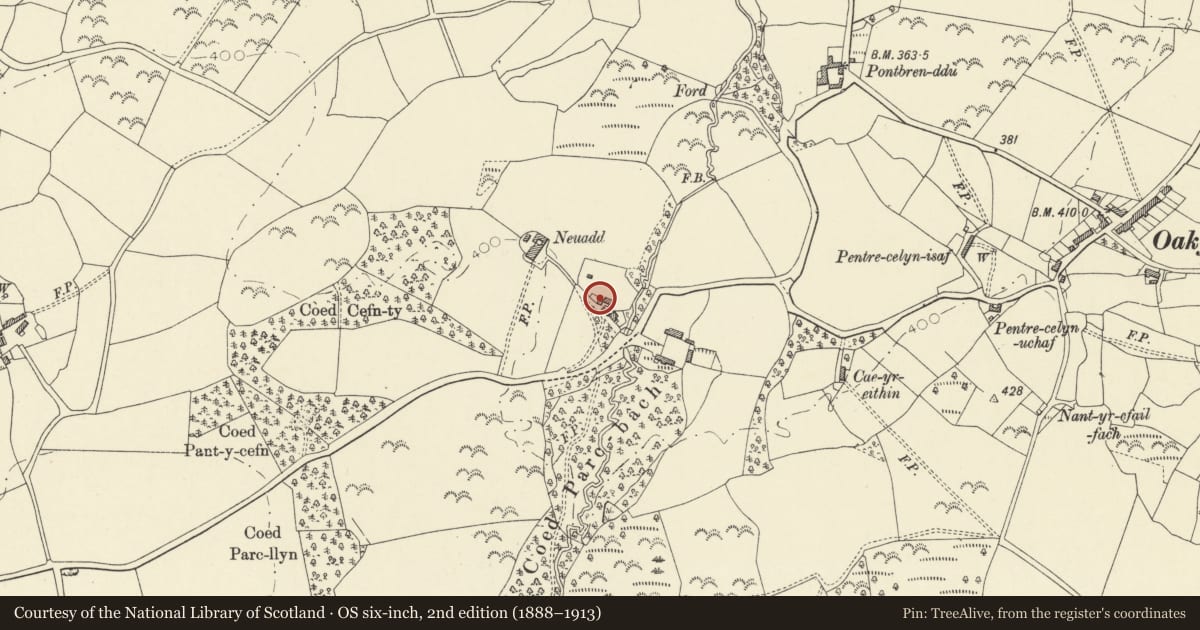
5 historical maps cover this location, the earliest the 1608 map "(13) Cambriae Typus." (David Rumsey Map Collection, Stanford Libraries).
Historical maps covering this location
- 1608 · (13) Cambriae Typus. (David Rumsey Map Collection, Stanford Libraries)
- 1830 · V.3:11-15:XV. Britisches Reich. A. Kon: England. b. Frstenthum Wales: Shire: 37-40 (David Rumsey Map Collection, Stanford Libraries)
- 1899 · 194 Llangranog (Hills) (David Rumsey Map Collection, Stanford Libraries)
- 1901 · Sheet 14. (David Rumsey Map Collection, Stanford Libraries)
- 1919 · Sheet 78. Lampeter. (David Rumsey Map Collection, Stanford Libraries)
Cadw's description
Location
Situated some 150m SE of Neuadd, fronting onto entrance drive.
History
Mid C19 coach-house to Neuadd, converted to holiday accommodation late C20. Not marked on 1840 Tithe Map. An L-plan building to S (not included in listing) is older, a converted house and stable range said to have timber beam dated IBF 1754 and moulded first floor fireplace.
Exterior
Rubble stone with slate roof, and C20 short stone front gable stack. Two storeys, gable front with two big round arches and narrow pier between. First floor long narrow arched window. Stone voussoirs. C20 glazing to all three openings, C20 wavy-edged bargeboards. S side has 2 C20 short windows under eaves and door with stone voussoirs to right. C20 lean-to on N side.
Reason for designation
Included as example of estate coach-house.
Nearby in the register
- NeuaddDomesticunder 1 mi
- Outbuildings to NE of NeuaddAgriculture and Subsistenceunder 1 mi
- Rhydgwnllanau ( attached house to former Post Office )Domesticunder 1 mi
- Telephone Call-box (01545 580469)Communicationsunder 1 mi
Other entries of the same register within about three miles of this one, by straight line.