Cof Cymru: National Historic Assets of Wales · Wales
Pant-y-Bettws
Llanfihangel Rhos-y-Corn, Carmarthenshire, Wales
A Grade II listed building in Llanfihangel Rhos y Corn, Carmarthenshire, designated on 18 March 1975.
The record
- Designation
- Listed building, Grade II
- Broad class
- Domestic
- Date of designation
- 18 March 1975
- Locality
- Llanfihangel Rhos y Corn
- Community
- Llanfihangel Rhos-y-Corn
- Unitary authority
- Carmarthenshire
- Country
- Wales
- Coordinates
- 51.98988, -4.11720
- Cadw reference
- 9725
Slide toward Today to fade the historical sheet and see the modern map underneath.
David Rumsey Map Collection, Stanford LibrariesDavid Rumsey Map Collection, Stanford LibrariesDavid Rumsey Map Collection, Stanford LibrariesDavid Rumsey Map Collection, Stanford LibrariesDavid Rumsey Map Collection, Stanford Libraries
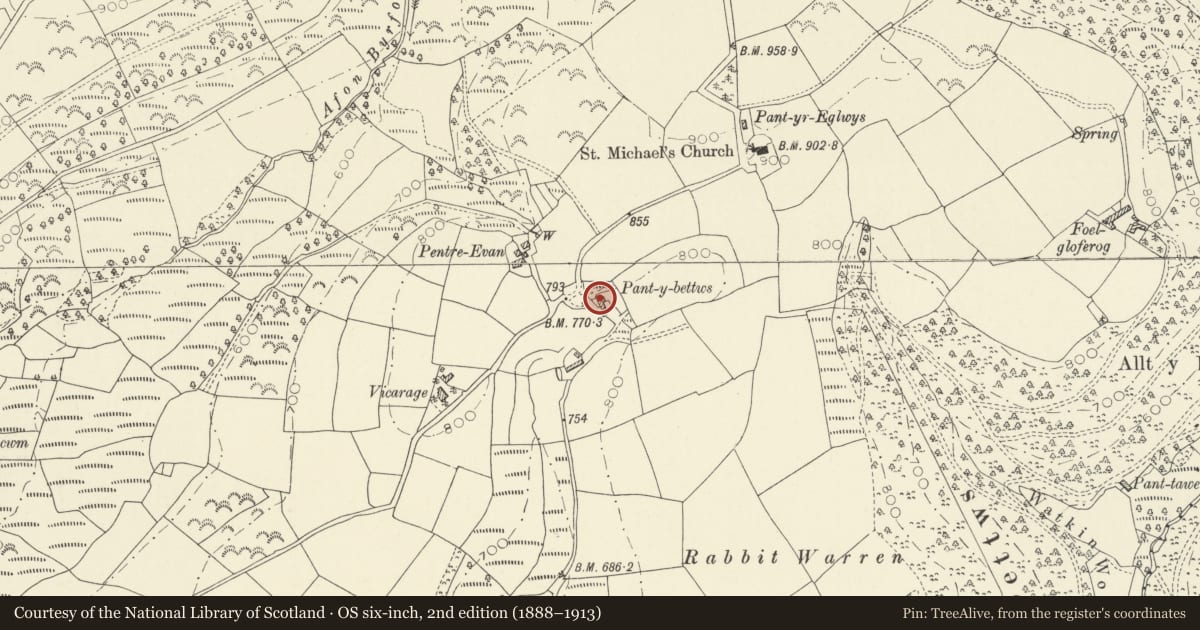
5 historical maps cover this location, the earliest the 1860 map "41. Caermathen." (David Rumsey Map Collection, Stanford Libraries).
Historical maps covering this location
- 1860 · 41. Caermathen. (David Rumsey Map Collection, Stanford Libraries)
- 1891 · Sheet 10. Ordnance Survey of England and Wales. . (David Rumsey Map Collection, Stanford Libraries)
- 1898 · 212 Llandovery (Outline) (David Rumsey Map Collection, Stanford Libraries)
- 1898 · 212 Llandovery (Hills) (David Rumsey Map Collection, Stanford Libraries)
- 1901 · Sheet 14. (David Rumsey Map Collection, Stanford Libraries)
Cadw's description
Location
Approximately 300m SW of the parish church, set back from and below the S side of a minor road between Gwernogle and Llanfihangel Rhos y Corn.
History
A C17 longhouse, altered in 1750 (date on building) when a central entrance was provided for the house. The house was derelict in the third quarter of the C20 but was subsequently restored, at which time the byre was completely rebuilt.
Exterior
A 1½-storey house with rebuilt former byre at the downhill end, of rubble stone with slate roof. The original house has a square C17 stone stack to the R and smaller stone stack to the L. Of the original house, the 4-window front has a central former entrance now converted to a window, above which is a small stone tablet inscribed 1750 and the initials 'M' over 'ED'. Windows in the lower storey are replaced under renewed lintels. In the upper storey small windows are beneath renewed lintels below the eaves. The byre end is rebuilt with inserted openings, although a doorway is incorporated in the original position of the longhouse entrance to the R of the hall stack. The 3-window rear of the house has skylights and replaced windows.
Interior
The original entrance to the domestic accommodation is beside the original hall fireplace, which retains a timber lintel. The original house is now a single room. Sawn roof trusses are C19 replacements.
Reason for designation
Listed, notwithstanding restoration, as a rare surviving longhouse of a type once characteristic of Carmarthenshire.
Nearby in the register
- Church of St MichaelReligious, Ritual and Funeraryunder 1 mi
- Pont Cwmmawr-duTransport1 mi
- Maes-y-BidiauDomestic1 mi
- Capel NewyddReligious, Ritual and Funerary2 mi
Other entries of the same register within about three miles of this one, by straight line.