Cof Cymru: National Historic Assets of Wales · Wales
Tower of St Hilary's Church
Denbigh, Denbighshire, Wales
A Grade I listed building in Denbigh - Castle, Denbigh, Denbighshire, designated on 24 October 1950.
The record
- Designation
- Listed building, Grade I
- Broad class
- Religious, Ritual and Funerary
- Date of designation
- 24 October 1950
- Locality
- Denbigh - Castle
- Community
- Denbigh
- Unitary authority
- Denbighshire
- Country
- Wales
- Coordinates
- 53.18175, -3.41985
- Cadw reference
- 969
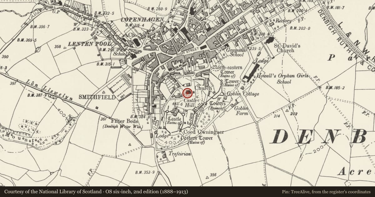
Slide toward Today to fade the historical sheet and see the modern map underneath.
David Rumsey Map Collection, Stanford LibrariesLlyfrgell Genedlaethol Cymru – The National Library of WalesDavid Rumsey Map Collection, Stanford LibrariesDavid Rumsey Map Collection, Stanford LibrariesDavid Rumsey Map Collection, Stanford Libraries
5 historical maps cover this location, the earliest the 1608 map "(13) Cambriae Typus." (David Rumsey Map Collection, Stanford Libraries).
Historical maps covering this location
- 1608 · (13) Cambriae Typus. (David Rumsey Map Collection, Stanford Libraries)
- 1795 · To Sir Watkin Williams-Wynn Bart ... the map of the six counties of North Wales is most… (Llyfrgell Genedlaethol Cymru – The National Library of Wales)
- 1830 · V.3:11-15:XV. Britisches Reich. A. Kon: England. b. Frstenthum Wales: Shire: 37-40 (David Rumsey Map Collection, Stanford Libraries)
- 1883 · Watershed map England, Wales 3. (David Rumsey Map Collection, Stanford Libraries)
- 1901 · Sheet 9 and 10. (David Rumsey Map Collection, Stanford Libraries)
Cadw's description
Location
Located within the walls of the old town immediately N of and below the castle.
History
The chapel (or church) of St Hilary was conceived from the first as an integral part of Henry de Lacy, Earl of Lincoln's borough town foundation of c1290. As the only church within the town walls (the parish church, St Marcella's being 1.6km distant), it served the needs of both the castle garrison and the citizens of the town. Its first mention, in 1334, refers to the 'chapel within the walls' and Leland, in the 1530s, described it as a 'goodlye and large chappelle in the old towne... whither most of the new towne do yett cumme.' The church was of medium size and consisted of a nave, chancel and W tower; a N aisle was added in the early C18. Following the building of the new town church (St Mary's, Lenten Pool) in 1874, the church was abandoned; in 1923 all save the tower was demolished. A dossal fragment of 1530, known to have hung in St Hilary's until the late C19, is now at St Mary's Lenten Pool. The Tower is probably an early C14 addition to the original nave and chancel; its battlemented parapet is probably C15.
During the Civil War King Charles Ist visited the beleagured Castle governor, Colonel Salesbury, and stayed for three days. On Sunday 28th September 1645 a service was held at St Hilary's attended by the King, the Archbishop of York, Lord Keeper Williams and various other dignitaries.
Exterior
Square, 3-stage embattled church tower, approximately 14m high. Of limestone rubble with green and red/brown sandstone dressings. Pointed-arched W entrance with inner arch; continuous moulding with no capitals. This has a ribbed, boarded door, probably C16 with restorations. The second stage has single lights to the S and N faces; paired, arched windows to the bell stage, with horizontal wooden slatting. Crenellated parapet above a simple stringcourse, with simple projecting sandstone gargoyles.
The W gable of the nave survives, and has a blocked four-centred arch to the tower.
Reason for designation
Listed Grade I for its special importance as the tower to the former garrison church of Denbigh's medieval castle and walled town.
Scheduled Ancient Monuments (AM 5 RCAM 127).
Nearby in the register
- St Hilary's ChapelTowerunder 1 mi
- 54 Tower HillDomesticunder 1 mi
- 52 Tower HillDomesticunder 1 mi
- Denbigh Medieval Town (North - Eastern Corner)Townunder 1 mi
Other entries of the same register within about three miles of this one, by straight line.