Cof Cymru: National Historic Assets of Wales · Wales
Section of Boundry Walls around Castle grounds running E from outer Gatehouse
Laugharne Township, Carmarthenshire, Wales
A Grade II listed building in Laugharne Township, Carmarthenshire, designated on 25 September 1986.
The record
- Designation
- Listed building, Grade II
- Broad class
- Defence
- Date of designation
- 25 September 1986
- Community
- Laugharne Township
- Unitary authority
- Carmarthenshire
- Country
- Wales
- Coordinates
- 51.76972, -4.46134
- Cadw reference
- 9655
Slide toward Today to fade the historical sheet and see the modern map underneath.
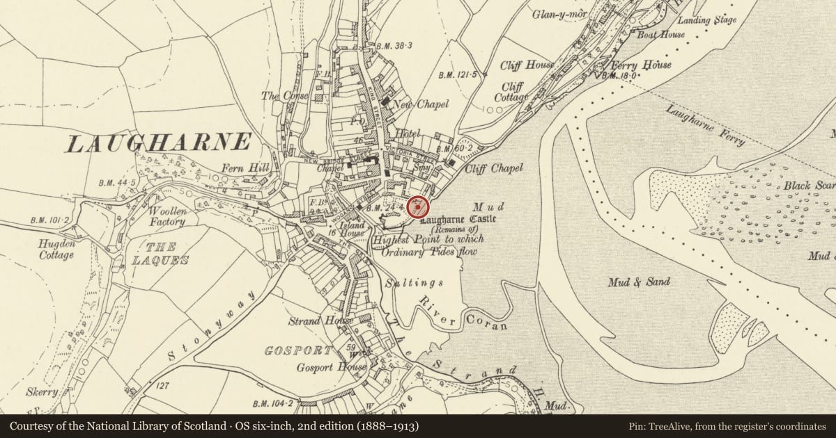
David Rumsey Map Collection, Stanford LibrariesDavid Rumsey Map Collection, Stanford LibrariesDavid Rumsey Map Collection, Stanford LibrariesDavid Rumsey Map Collection, Stanford LibrariesDavid Rumsey Map Collection, Stanford Libraries
5 historical maps cover this location, the earliest the 1636 map "Cornubia : Devonia, Somersetus, Dorcestria, Wiltonia, Glocestria ..." (David Rumsey Map Collection, Stanford Libraries).
Historical maps covering this location
- 1636 · Cornubia : Devonia, Somersetus, Dorcestria, Wiltonia, Glocestria ... (David Rumsey Map Collection, Stanford Libraries)
- 1860 · 41. Caermathen. (David Rumsey Map Collection, Stanford Libraries)
- 1891 · Sheet 10. Ordnance Survey of England and Wales. . (David Rumsey Map Collection, Stanford Libraries)
- 1898 · 229 Carmarthen (Hills) (David Rumsey Map Collection, Stanford Libraries)
- 1920 · Sheet 100. Llanelly. (David Rumsey Map Collection, Stanford Libraries)
Cadw's description
Location
Adjoining Outer Gatehouse and reached by a path in front of Castle House.
Exterior
Rubble wall running SW from Outer Gatehouse and serving as revetment wall to the elevated outer ward with Wogan Street below, part crenellated. Right-angle SE turn above Island House, ruined probably C18 garden wall on top of and incorporating the late C13 curtain wall adjoining SW castle tower at SE end.
A second section of wall runs E from outer gatehouse; rubble to W end but mostly late C18/early C19 Flemish bond brick build against earlier rubble wall to N side.
Arched openings, one with classical detail lead to Castle House garden; slate roof rubble lean-to's on N side.
Rubble wall with some ruined crenellations adjoins at right angles running along cliff edge to gazebo and reaching down to foreshore.
Reason for designation
In a Scheduled Ancient Monument site.
Group value.
Nearby in the register
- Gazebo in grounds of Laugharne CastleGardens, Parks and Urban Spacesunder 1 mi
- Laugharne CastleDefenceunder 1 mi
- Laugharne CastleCastleunder 1 mi
- Sea ViewEducationunder 1 mi
Other entries of the same register within about three miles of this one, by straight line.