Cof Cymru: National Historic Assets of Wales · Wales
Gosport House
Laugharne Township, Carmarthenshire, Wales
A Grade II listed building in Laugharne Township, Carmarthenshire, designated on 25 September 1986.
The record
- Designation
- Listed building, Grade II
- Broad class
- Domestic
- Date of designation
- 25 September 1986
- Community
- Laugharne Township
- Unitary authority
- Carmarthenshire
- Country
- Wales
- Coordinates
- 51.76678, -4.46264
- Cadw reference
- 9629
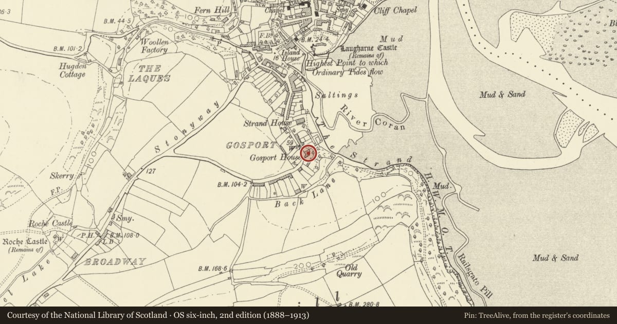
Slide toward Today to fade the historical sheet and see the modern map underneath.
David Rumsey Map Collection, Stanford LibrariesDavid Rumsey Map Collection, Stanford LibrariesDavid Rumsey Map Collection, Stanford LibrariesDavid Rumsey Map Collection, Stanford LibrariesDavid Rumsey Map Collection, Stanford Libraries
5 historical maps cover this location, the earliest the 1636 map "Cornubia : Devonia, Somersetus, Dorcestria, Wiltonia, Glocestria ..." (David Rumsey Map Collection, Stanford Libraries).
Historical maps covering this location
- 1636 · Cornubia : Devonia, Somersetus, Dorcestria, Wiltonia, Glocestria ... (David Rumsey Map Collection, Stanford Libraries)
- 1860 · 41. Caermathen. (David Rumsey Map Collection, Stanford Libraries)
- 1891 · Sheet 10. Ordnance Survey of England and Wales. . (David Rumsey Map Collection, Stanford Libraries)
- 1898 · 229 Carmarthen (Hills) (David Rumsey Map Collection, Stanford Libraries)
- 1920 · Sheet 100. Llanelly. (David Rumsey Map Collection, Stanford Libraries)
Cadw's description
Location
On a bend in the road enclosed behind rubble boundary wall; ground falls away steeply to rear.
History
Z-plan, 2-storey structure with C17 origins, subsequent decay and early C20 reconstruction. Vandyck and Cromwell are believed to have stayed here, the latter to watch the siege of the castle.
Exterior
Rubble masonry, modern roof, wide eaves, 3 brick chimney stacks and 1 large rubble stack to W end wall. Paired casement windows with leaded lights to all ranges with cambered brick voussoirs to N end; swept roof dormers to W range. Vertical joint suggests E range to be a different period. Modern extension to and modern porch with 6-panel door at angle between main and W ranges.
Rubble wall with brick voussoired pointed arch entrance adjoins rubble chimney breast and runs S to iron gate entry into stable courtyard.
Interior
Interior retains probably earlier C17 seven-well plain plaster ceiling with roll moulding to beam edges; deep windows splays.
Nearby in the register
- Ball CourtDomesticunder 1 mi
- Strand HouseDomesticunder 1 mi
- The StrandDomesticunder 1 mi
- Boundry Wall to Island HouseDomesticunder 1 mi
Other entries of the same register within about three miles of this one, by straight line.