Cof Cymru: National Historic Assets of Wales · Wales
Dwarf walls, railings and gate to No 8
Carmarthen, Carmarthenshire, Wales
A Grade II listed building in Carmarthen, Carmarthenshire, designated on 19 May 1981.
The record
- Designation
- Listed building, Grade II
- Broad class
- Domestic
- Date of designation
- 19 May 1981
- Community
- Carmarthen
- Unitary authority
- Carmarthenshire
- Country
- Wales
- Coordinates
- 51.85964, -4.30788
- Cadw reference
- 9620
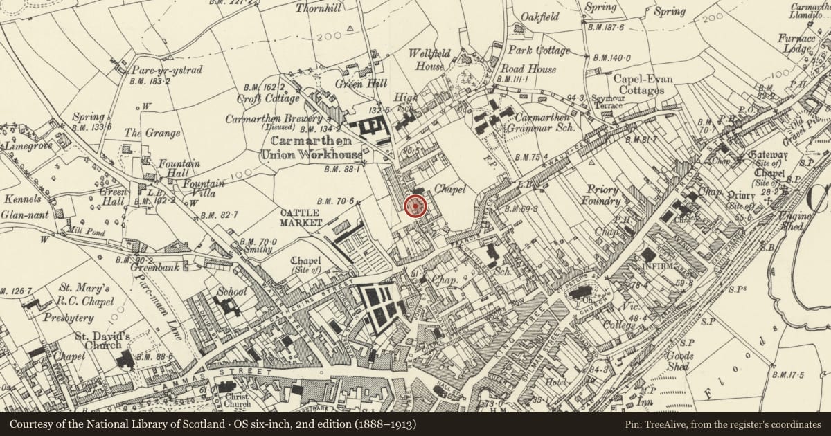
Slide toward Today to fade the historical sheet and see the modern map underneath.
David Rumsey Map Collection, Stanford LibrariesDavid Rumsey Map Collection, Stanford LibrariesDavid Rumsey Map Collection, Stanford LibrariesDavid Rumsey Map Collection, Stanford LibrariesDavid Rumsey Map Collection, Stanford Libraries
5 historical maps cover this location, the earliest the 1636 map "Cornubia : Devonia, Somersetus, Dorcestria, Wiltonia, Glocestria ..." (David Rumsey Map Collection, Stanford Libraries).
Historical maps covering this location
- 1636 · Cornubia : Devonia, Somersetus, Dorcestria, Wiltonia, Glocestria ... (David Rumsey Map Collection, Stanford Libraries)
- 1860 · 41. Caermathen. (David Rumsey Map Collection, Stanford Libraries)
- 1891 · Sheet 10. Ordnance Survey of England and Wales. . (David Rumsey Map Collection, Stanford Libraries)
- 1898 · 229 Carmarthen (Hills) (David Rumsey Map Collection, Stanford Libraries)
- 1901 · Sheet 14. (David Rumsey Map Collection, Stanford Libraries)
Cadw's description
Location
Situated to front of property which is roughly midway along street.
History
Earlier C19 wrought iron railings and gate similar to those on No 2 and on Picton Terrace.
Exterior
Dwarf wall in roughcast render with slate coping. Wrought iron railings similar to No 2 with spiked finials with flanking scrolls alternately rising above middle and upper horizontal bars. Stanchions with urn finials. Matching gate.
Reason for designation
Included as a good example of local ironwork of the earlier C19 and for group value with the house.
Nearby in the register
- 8 Waterloo TerraceDomesticunder 1 mi
- Meiros HallDomesticunder 1 mi
- Dwarf walls, railings and gate to No 2Domesticunder 1 mi
- 2 Barn RoadDomesticunder 1 mi
Other entries of the same register within about three miles of this one, by straight line.