Cof Cymru: National Historic Assets of Wales · Wales
14 Spilman Street
Carmarthen, Carmarthenshire, Wales
A Grade II listed building in Carmarthen, Carmarthenshire, designated on 19 May 1981.
The record
- Designation
- Listed building, Grade II
- Broad class
- Domestic
- Date of designation
- 19 May 1981
- Community
- Carmarthen
- Unitary authority
- Carmarthenshire
- Country
- Wales
- Coordinates
- 51.85703, -4.30348
- Cadw reference
- 9600
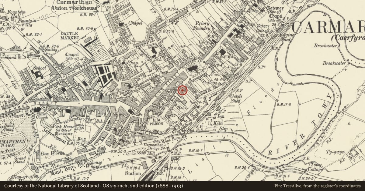
Slide toward Today to fade the historical sheet and see the modern map underneath.
David Rumsey Map Collection, Stanford LibrariesDavid Rumsey Map Collection, Stanford LibrariesDavid Rumsey Map Collection, Stanford LibrariesDavid Rumsey Map Collection, Stanford LibrariesDavid Rumsey Map Collection, Stanford Libraries
5 historical maps cover this location, the earliest the 1636 map "Cornubia : Devonia, Somersetus, Dorcestria, Wiltonia, Glocestria ..." (David Rumsey Map Collection, Stanford Libraries).
Historical maps covering this location
- 1636 · Cornubia : Devonia, Somersetus, Dorcestria, Wiltonia, Glocestria ... (David Rumsey Map Collection, Stanford Libraries)
- 1860 · 41. Caermathen. (David Rumsey Map Collection, Stanford Libraries)
- 1891 · Sheet 10. Ordnance Survey of England and Wales. . (David Rumsey Map Collection, Stanford Libraries)
- 1898 · 229 Carmarthen (Hills) (David Rumsey Map Collection, Stanford Libraries)
- 1901 · Sheet 14. (David Rumsey Map Collection, Stanford Libraries)
Cadw's description
Location
Situated approximately 30m SW of junction with Parade Road, on W side of forecourt to Napier House.
History
Built in the earlier C19, possibly as a pair to No 12, framing forecourt of No 13, Napier House, marked on 1834 map. The Coach and Horses public house in later C19 and either No 14 or No 15 was the Star and Garter public house attacked by a mob during riots in 1832. It is now part of the premises of Morris Roberts' Solicitors with No 15. The window and door details suggest a refurbishment in the mid to later C19.
Exterior
End-terrace house, in painted roughcast with hipped slate roof, possibly planned as pair to No 12. Two storey, 3-window range with 2 brick stacks on rear roof slopes. Raised plinth, 5-panel door to centre with plate-glass overlight and timber door-case of plain pilasters, scroll brackets and flat cornice. Marginally-glazed plate-glass large horned sashes with painted stone sills, in raised moulded stucco frames. Plain eaves board and cast iron rainwater goods. W end wall has one window to ground floor right.
Interior
Altered when connected to Number 15. Earlier C19 staircase with straight balusters mentioned in 1981 has gone.
Reason for designation
Included as a C19 house of formal design, one of the pair of houses that frame the courtyard of No 13.
Nearby in the register
- 15 Spilman StreetDomesticunder 1 mi
- Napier HouseDomesticunder 1 mi
- 16 Spilman StreetDomesticunder 1 mi
- 12 Spilman StreetCommercialunder 1 mi
Other entries of the same register within about three miles of this one, by straight line.