Cof Cymru: National Historic Assets of Wales · Wales
Arch and gate in front garden wall to Pontgarreg Cottage
Carmarthen, Carmarthenshire, Wales
A Grade II listed building in Johnstown, Carmarthen, Carmarthenshire, designated on 19 May 1981.
The record
- Designation
- Listed building, Grade II
- Broad class
- Domestic
- Date of designation
- 19 May 1981
- Locality
- Johnstown
- Community
- Carmarthen
- Unitary authority
- Carmarthenshire
- Country
- Wales
- Coordinates
- 51.85151, -4.33500
- Cadw reference
- 9583
Slide toward Today to fade the historical sheet and see the modern map underneath.
David Rumsey Map Collection, Stanford LibrariesDavid Rumsey Map Collection, Stanford LibrariesDavid Rumsey Map Collection, Stanford LibrariesDavid Rumsey Map Collection, Stanford LibrariesDavid Rumsey Map Collection, Stanford Libraries
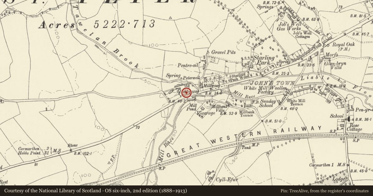
5 historical maps cover this location, the earliest the 1636 map "Cornubia : Devonia, Somersetus, Dorcestria, Wiltonia, Glocestria ..." (David Rumsey Map Collection, Stanford Libraries).
Historical maps covering this location
- 1636 · Cornubia : Devonia, Somersetus, Dorcestria, Wiltonia, Glocestria ... (David Rumsey Map Collection, Stanford Libraries)
- 1860 · 41. Caermathen. (David Rumsey Map Collection, Stanford Libraries)
- 1891 · Sheet 10. Ordnance Survey of England and Wales. . (David Rumsey Map Collection, Stanford Libraries)
- 1898 · 229 Carmarthen (Hills) (David Rumsey Map Collection, Stanford Libraries)
- 1901 · Sheet 14. (David Rumsey Map Collection, Stanford Libraries)
Cadw's description
Location
Situated in roadside garden wall of Pontgarreg Cottage.
History
Pedestrian gateway to garden of Pontgarreg Cottage, presumably earlier to mid C19.
Exterior
Red brick garden gateway with flat top and crude rounded-pointed arched opening. Cement coping. Wrought iron gate with elliptical-curved top rail and double mid-rail. Spiked uprights with good scrollwork between: scrolls between bars to lower section, then diagonal crosses between mid rails and small scrolls above. Upper section has just vertical bars terminated above top-bar in plain spike finials.
Reason for designation
Included as an unusual and decorative C19 pedestrian gate and for group value with Pontgarreg Cottage and barn.
Nearby in the register
- Pontgarreg CottageDomesticunder 1 mi
- Barn to SW of Pontgarreg CottageAgriculture and Subsistenceunder 1 mi
- Front garden walls, railings and gates to NantyfelinDomesticunder 1 mi
- NantyfelinDomesticunder 1 mi
Other entries of the same register within about three miles of this one, by straight line.