Cof Cymru: National Historic Assets of Wales · Wales
Forecourt rails, gates and piers to Capel Y Priordy
Carmarthen, Carmarthenshire, Wales
A Grade II listed building in Carmarthen, Carmarthenshire, designated on 19 May 1981.
The record
- Designation
- Listed building, Grade II
- Broad class
- Religious, Ritual and Funerary
- Date of designation
- 19 May 1981
- Community
- Carmarthen
- Unitary authority
- Carmarthenshire
- Country
- Wales
- Coordinates
- 51.86087, -4.29837
- Cadw reference
- 9550
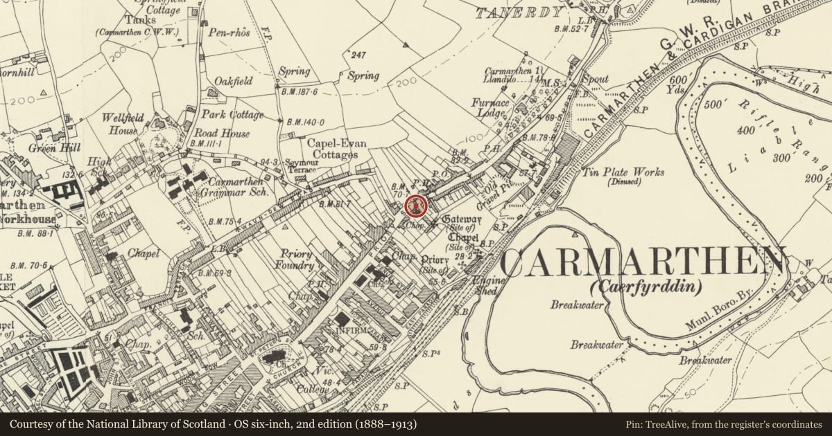
Slide toward Today to fade the historical sheet and see the modern map underneath.
David Rumsey Map Collection, Stanford LibrariesDavid Rumsey Map Collection, Stanford LibrariesDavid Rumsey Map Collection, Stanford LibrariesDavid Rumsey Map Collection, Stanford LibrariesDavid Rumsey Map Collection, Stanford Libraries
5 historical maps cover this location, the earliest the 1636 map "Cornubia : Devonia, Somersetus, Dorcestria, Wiltonia, Glocestria ..." (David Rumsey Map Collection, Stanford Libraries).
Historical maps covering this location
- 1636 · Cornubia : Devonia, Somersetus, Dorcestria, Wiltonia, Glocestria ... (David Rumsey Map Collection, Stanford Libraries)
- 1860 · 41. Caermathen. (David Rumsey Map Collection, Stanford Libraries)
- 1891 · Sheet 10. Ordnance Survey of England and Wales. . (David Rumsey Map Collection, Stanford Libraries)
- 1898 · 229 Carmarthen (Hills) (David Rumsey Map Collection, Stanford Libraries)
- 1901 · Sheet 14. (David Rumsey Map Collection, Stanford Libraries)
Cadw's description
Location
Situated in front of chapel just SW of junction with Old Priory Road.
History
Forecourt wall, railings and gates to Independent chapel of 1875 by George Morgan. Ironwork by W. Baker of Newport, Mon.
Exterior
Low wall of rubble stone with painted ashlar coping and cast-iron railing with top and bottom rail, and alternating broader and narrower rails of cross section. Chamfered cast-iron square standards with big fleur-de-lys finials. Panelled cast-iron gate posts with corniced caps and acorn finials, left gate post inscribed "Bakers Newport". Pair of broad iron gates with mid-rail and alternate fleur-de-lys finials.
Reason for designation
Included as a good example of later C19 ironwork and for group value with chapel.
Nearby in the register
- Y Priordy Independent ChapelReligious, Ritual and Funeraryunder 1 mi
- 31 Priory StreetCommercialunder 1 mi
- 7 Old Priory RoadDomesticunder 1 mi
- 7a Old Priory RoadDomesticunder 1 mi
Other entries of the same register within about three miles of this one, by straight line.