Cof Cymru: National Historic Assets of Wales · Wales
Railings, gates and gatepiers to St John's Church
Carmarthen, Carmarthenshire, Wales
A Grade II listed building in Carmarthen, Carmarthenshire, designated on 19 May 1981.
The record
- Designation
- Listed building, Grade II
- Broad class
- Religious, Ritual and Funerary
- Date of designation
- 19 May 1981
- Community
- Carmarthen
- Unitary authority
- Carmarthenshire
- Country
- Wales
- Coordinates
- 51.85955, -4.30012
- Cadw reference
- 9545
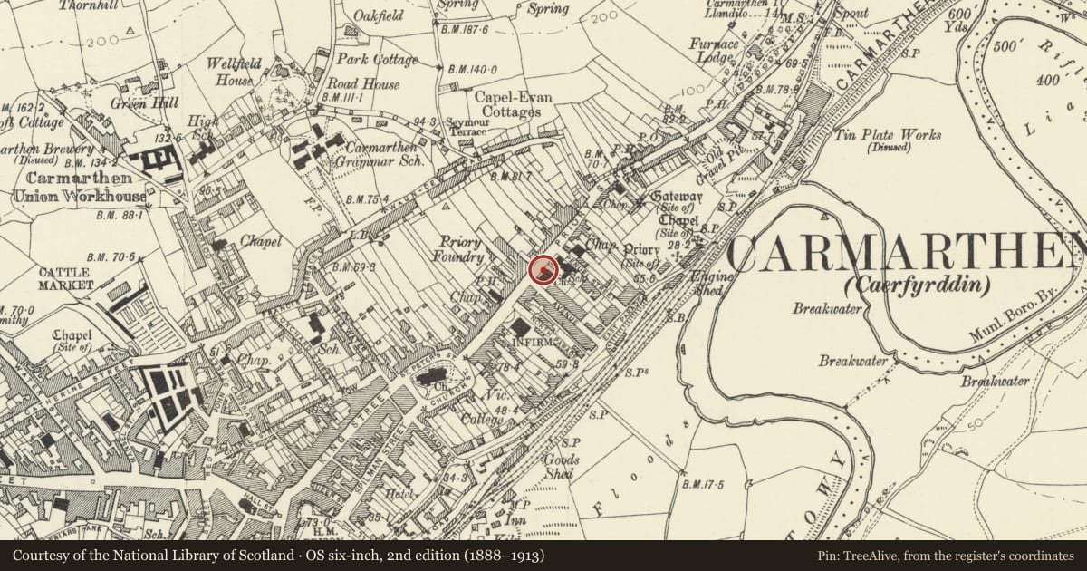
Slide toward Today to fade the historical sheet and see the modern map underneath.
David Rumsey Map Collection, Stanford LibrariesDavid Rumsey Map Collection, Stanford LibrariesDavid Rumsey Map Collection, Stanford LibrariesDavid Rumsey Map Collection, Stanford LibrariesDavid Rumsey Map Collection, Stanford Libraries
5 historical maps cover this location, the earliest the 1636 map "Cornubia : Devonia, Somersetus, Dorcestria, Wiltonia, Glocestria ..." (David Rumsey Map Collection, Stanford Libraries).
Historical maps covering this location
- 1636 · Cornubia : Devonia, Somersetus, Dorcestria, Wiltonia, Glocestria ... (David Rumsey Map Collection, Stanford Libraries)
- 1860 · 41. Caermathen. (David Rumsey Map Collection, Stanford Libraries)
- 1891 · Sheet 10. Ordnance Survey of England and Wales. . (David Rumsey Map Collection, Stanford Libraries)
- 1898 · 229 Carmarthen (Hills) (David Rumsey Map Collection, Stanford Libraries)
- 1901 · Sheet 14. (David Rumsey Map Collection, Stanford Libraries)
Cadw's description
Location
Situated along N and W sides of churchyard to church of St John.
History
Iron railings of 1893 to Church of St John, the gatepiers and standards marked as made by T. Jones and Son, Priory Foundry, Carmarthen. Railings are similar to those outside Heol Awst chapel, Lammas Street (gatepiers there marked Old Foundry, Carmarthen) and former Welsh Wesleyan chapel John Street (there marked W. Isaac & Sons).
Exterior
Iron railings with conical lance-head finials and low bottom rail with intermediate bars and smaller finials, on limestone coping. Double gates of similar design between large panelled cast-iron gate posts with cornice caps and tall ringed shaft finials with scroll supports and urn tops. Piers are marked T Jones and Sons, Priory Foundry, Carmarthen, Eglwys St Ioan, and St John's Church.
Reason for designation
Included as a good example of local iron work and for group value with St. John's Church.
Nearby in the register
- Eglwys Sant Ioan/Church of St JohnReligious, Ritual and Funeraryunder 1 mi
- Former Priory Street School with walls and railingsEducationunder 1 mi
- Entrance gates and rails to Penuel Baptist ChapelReligious, Ritual and Funeraryunder 1 mi
- Penuel Baptist Chapel and attached schoolroomReligious, Ritual and Funeraryunder 1 mi
Other entries of the same register within about three miles of this one, by straight line.