Cof Cymru: National Historic Assets of Wales · Wales
Gates, gatepiers and bollards to footpath on S side
Carmarthen, Carmarthenshire, Wales
A Grade II listed building in Carmarthen, Carmarthenshire, designated on 19 May 1981.
The record
- Designation
- Listed building, Grade II
- Broad class
- Gardens, Parks and Urban Spaces
- Date of designation
- 19 May 1981
- Community
- Carmarthen
- Unitary authority
- Carmarthenshire
- Country
- Wales
- Coordinates
- 51.85734, -4.30037
- Cadw reference
- 9516
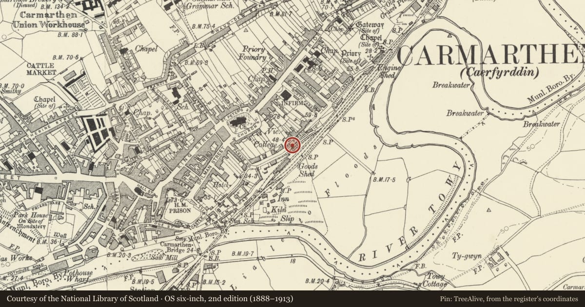
Slide toward Today to fade the historical sheet and see the modern map underneath.
David Rumsey Map Collection, Stanford LibrariesDavid Rumsey Map Collection, Stanford LibrariesDavid Rumsey Map Collection, Stanford LibrariesDavid Rumsey Map Collection, Stanford LibrariesDavid Rumsey Map Collection, Stanford Libraries
5 historical maps cover this location, the earliest the 1636 map "Cornubia : Devonia, Somersetus, Dorcestria, Wiltonia, Glocestria ..." (David Rumsey Map Collection, Stanford Libraries).
Historical maps covering this location
- 1636 · Cornubia : Devonia, Somersetus, Dorcestria, Wiltonia, Glocestria ... (David Rumsey Map Collection, Stanford Libraries)
- 1860 · 41. Caermathen. (David Rumsey Map Collection, Stanford Libraries)
- 1891 · Sheet 10. Ordnance Survey of England and Wales. . (David Rumsey Map Collection, Stanford Libraries)
- 1898 · 229 Carmarthen (Hills) (David Rumsey Map Collection, Stanford Libraries)
- 1901 · Sheet 14. (David Rumsey Map Collection, Stanford Libraries)
Cadw's description
Location
Situated at top of footpath from Under Parade Road, opposite No 10.
History
Small C19 pedestrian gate in wrought iron to footpath up to The Parade. The Parade was laid out by public subscription in 1782, a source in 1801 refers to music from a militia band and a long broad walk. A print of c1874 shows it lined on both sides with trees and shrubs.
Exterior
Small pair of iron gates at top end of footpath. Gates have spear-head rails, bottom, mid and top rails, the top rails on a slight curve up to meeting stile. The SE gate is fixed against a late C19 fluted cast-iron bollard with ball finial, inscribed "Jones and Sons, Priory Foundry, Carmarthen". Gates are flanked by plain stone piers projecting from flanking walls. Stretch of wall running E adjoining has triangular iron-slag coping stones. Gate was removed and re-erected 2002.
Reason for designation
Included as a small C19 pedestrian gate of locally-made ironwork, part of an interesting scheme of urban planning with its origin in the late C18.
Nearby in the register
- 10 The ParadeDomesticunder 1 mi
- 9 The ParadeDomesticunder 1 mi
- Min-yr-Afon, including railings and gateDomesticunder 1 mi
- No 7 including railings and gateDomesticunder 1 mi
Other entries of the same register within about three miles of this one, by straight line.