Cof Cymru: National Historic Assets of Wales · Wales
Orville House
Ruthin, Denbighshire, Wales
A Grade II listed building in Ruthin East, Ruthin, Denbighshire, designated on 16 May 1978.
The record
- Designation
- Listed building, Grade II
- Broad class
- Domestic
- Date of designation
- 16 May 1978
- Locality
- Ruthin East
- Town
- Ruthin
- Community
- Ruthin
- Unitary authority
- Denbighshire
- Country
- Wales
- Coordinates
- 53.11440, -3.30581
- Cadw reference
- 948
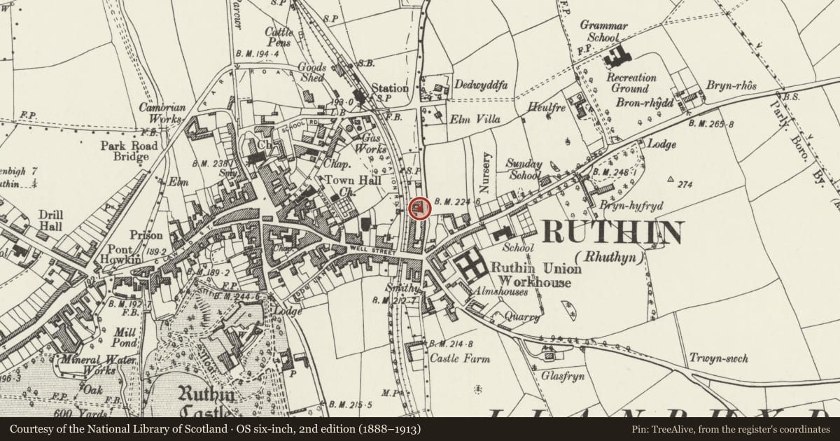
Slide toward Today to fade the historical sheet and see the modern map underneath.
David Rumsey Map Collection, Stanford LibrariesDavid Rumsey Map Collection, Stanford LibrariesDavid Rumsey Map Collection, Stanford LibrariesLlyfrgell Genedlaethol Cymru – The National Library of WalesDavid Rumsey Map Collection, Stanford Libraries
5 historical maps cover this location, the earliest the 1795 map "To Sir Watkin Williams-Wynn Bart ... the map of the six counties of North Wales is most humbly inscribed by his obedient humble servant" (Llyfrgell Genedlaethol Cymru – The National Library of Wales).
Historical maps covering this location
- 1795 · To Sir Watkin Williams-Wynn Bart ... the map of the six counties of North Wales is most… (Llyfrgell Genedlaethol Cymru – The National Library of Wales)
- 1883 · Watershed map England, Wales 3. (David Rumsey Map Collection, Stanford Libraries)
- 1898 · 108 Flint (Hills) (David Rumsey Map Collection, Stanford Libraries)
- 1898 · 108 Flint (Outline) (David Rumsey Map Collection, Stanford Libraries)
- 1901 · Sheet 9 and 10. (David Rumsey Map Collection, Stanford Libraries)
Cadw's description
Location
At the S end of a row of 3 houses fronting the road.
History
Probably mid-C19. Oroville House was probably a Public House known as the Bowling Green.
Exterior
Oroville House, Rosewood Cottage and Salop House form a group.
A terrace of 3 Picturesque cottages, the central one slightly set back. Each cottage is symmetrical, 2-storey, 3-window, with an advanced central bay. The cottages are roughcast under slate roofs with central brick ridge stacks; the upper storey on projecting brackets to suggest timber framing. The windows are mainly late C20 plain-glazed wooden casements.
Oroville House has an advanced full-height gabled bay to centre with scalloped barge boards, the entrance containing a late C20 half-glazed door. The stack is roughcast. No openings to S gable end. Rear has catslide, the S end with a single top-hung light to each storey. A modernised house adjoins to the L.
Interior
Interior not seen.
Reason for designation
Listed, notwithstanding alterations to openings, as an unusual group of mid-C19 Picturesque cottages retaining their character.
Nearby in the register
- Rosewood CottageNo class recordedunder 1 mi
- Salop HouseNo class recordedunder 1 mi
- 14 Railway TerraceNo class recordedunder 1 mi
- 13 Railway TerraceNo class recordedunder 1 mi
Other entries of the same register within about three miles of this one, by straight line.