Cof Cymru: National Historic Assets of Wales · Wales
Gates at former NE entrance to Y Garreg Filltir
Carmarthen, Carmarthenshire, Wales
A Grade II listed building in Abbey Mead, Carmarthen, Carmarthenshire, designated on 19 May 1981.
The record
- Designation
- Listed building, Grade II
- Broad class
- Domestic
- Date of designation
- 19 May 1981
- Locality
- Abbey Mead
- Community
- Carmarthen
- Unitary authority
- Carmarthenshire
- Country
- Wales
- Coordinates
- 51.86297, -4.29431
- Cadw reference
- 9420
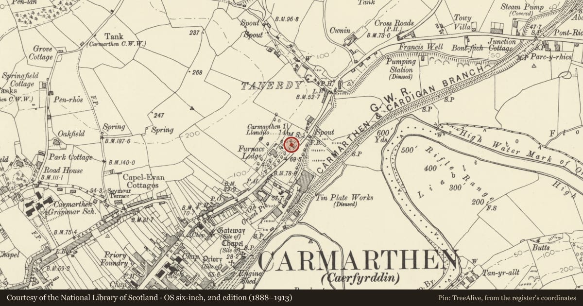
Slide toward Today to fade the historical sheet and see the modern map underneath.
David Rumsey Map Collection, Stanford LibrariesDavid Rumsey Map Collection, Stanford LibrariesDavid Rumsey Map Collection, Stanford LibrariesDavid Rumsey Map Collection, Stanford LibrariesDavid Rumsey Map Collection, Stanford Libraries
5 historical maps cover this location, the earliest the 1636 map "Cornubia : Devonia, Somersetus, Dorcestria, Wiltonia, Glocestria ..." (David Rumsey Map Collection, Stanford Libraries).
Historical maps covering this location
- 1636 · Cornubia : Devonia, Somersetus, Dorcestria, Wiltonia, Glocestria ... (David Rumsey Map Collection, Stanford Libraries)
- 1860 · 41. Caermathen. (David Rumsey Map Collection, Stanford Libraries)
- 1891 · Sheet 10. Ordnance Survey of England and Wales. . (David Rumsey Map Collection, Stanford Libraries)
- 1898 · 229 Carmarthen (Hills) (David Rumsey Map Collection, Stanford Libraries)
- 1901 · Sheet 14. (David Rumsey Map Collection, Stanford Libraries)
Cadw's description
Location
Situated up disused former drive, nearly opposite entry to Furnace Bank.
History
C19 iron gates to former NE drive to Y Garreg Filltir, formerly called Furnace Lodge, then Milestone, said to have been built in 1801 and to have been the manager's house of the iron and tinworks below the main road. The ironwork is unusually rustic and characterful.
Exterior
Two wide wrought iron gates with square uprights rising alternately above middle and top rails. Heavy top rail is curved down to hanging stile on each gate. Unusual wrought iron openwork finials: diamond finials above middle rails and alternate diamonds and hearts to top rail with wrought iron scrolls. Stone piers probably rebuilt in late C20.
Reason for designation
Included as an unusual C19 iron pair of gates, probably of local manufacture, of group value with the house.
Nearby in the register
- Milestone in base of retaining wall to Y Garreg FilltirTransportunder 1 mi
- Y Garreg Filltir with rear low wall and railingDomesticunder 1 mi
- Entrance gates to Y Garreg FilltirDomesticunder 1 mi
- Former Upper Tin MillsIndustrialunder 1 mi
Other entries of the same register within about three miles of this one, by straight line.