Cof Cymru: National Historic Assets of Wales · Wales
Pont Henllan, including walled approaches..
Llangeler, Carmarthenshire, Wales
A Grade II listed building in Henllan, Llandysul, Llangeler, Carmarthenshire, designated on 23 June 1967.
The record
- Designation
- Listed building, Grade II
- Broad class
- Transport
- Date of designation
- 23 June 1967
- Locality
- Henllan
- Town
- Llandysul
- Community
- Llangeler
- Unitary authority
- Carmarthenshire
- Country
- Wales
- Coordinates
- 52.03458, -4.39850
- Cadw reference
- 9376
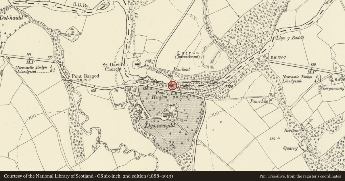
Slide toward Today to fade the historical sheet and see the modern map underneath.
David Rumsey Map Collection, Stanford LibrariesDavid Rumsey Map Collection, Stanford LibrariesDavid Rumsey Map Collection, Stanford LibrariesDavid Rumsey Map Collection, Stanford LibrariesDavid Rumsey Map Collection, Stanford Libraries
5 historical maps cover this location, the earliest the 1830 map "V.3:11-15:XV. Britisches Reich. A. Kon: England. b. Frstenthum Wales: Shire: 37-40" (David Rumsey Map Collection, Stanford Libraries).
Historical maps covering this location
- 1830 · V.3:11-15:XV. Britisches Reich. A. Kon: England. b. Frstenthum Wales: Shire: 37-40 (David Rumsey Map Collection, Stanford Libraries)
- 1860 · 41. Caermathen. (David Rumsey Map Collection, Stanford Libraries)
- 1891 · Sheet 10. Ordnance Survey of England and Wales. . (David Rumsey Map Collection, Stanford Libraries)
- 1898 · 211 Newcastle Emlyn (Hills) (David Rumsey Map Collection, Stanford Libraries)
- 1901 · Sheet 14. (David Rumsey Map Collection, Stanford Libraries)
Cadw's description
Location
Situated over the river Teifi, and across the parish and county boundary, immediately N of the junction with the main Cardigan-Carmarthen Road.
History
Road bridge over the Teifi. The bridge bears a plaque of 1774 though this may not be the original date.
Exterior
Rubble stone bridge of C18, with later restorations, on 3 semi-circular headed arches with cut stone voussoirs. Higher centre arch. Arches separated by cutwater buttresses to parapet level, forming refuges, except for the northernmost one on the downstream side which has been truncated, capped in cement render at carriageway level. Stone, coped, parapet wall, projecting slightly to S between cutwaters, over central arch.. Stone plaque visible on S face of NE cutwater, possibly re-set, engraved "E D Z E. J D J T. I E J J. 1774". Continuous wall extends S to roadway on both sides - with replacement parapet in snecked stone to SE corner. Similar wall extends to NW, following road line, battered base to NW terminal.
Reason for designation
Included as a fine early stone bridge with a good date stone.
Nearby in the register
- Pont Henllan ( Partly in Llangeler Community )Transportunder 1 mi
- Pont Henllan PillboxPillboxunder 1 mi
- Former P.O.W. Chapel at Henllan Caravan ParkReligious, Ritual and Funeraryunder 1 mi
- Defended Enclosure 250m NE of Pont HenllanPromontory Fort - inlandunder 1 mi
Other entries of the same register within about three miles of this one, by straight line.