Cof Cymru: National Historic Assets of Wales · Wales
Carnau
Penybont, Powys, Wales
A Grade II listed building in Llandegley, Penybont, Powys, designated on 11 August 1993.
The record
- Designation
- Listed building, Grade II
- Broad class
- Domestic
- Date of designation
- 11 August 1993
- Locality
- Llandegley
- Community
- Penybont
- Unitary authority
- Powys
- Country
- Wales
- Coordinates
- 52.25968, -3.27406
- Cadw reference
- 9310
Slide toward Today to fade the historical sheet and see the modern map underneath.
David Rumsey Map Collection, Stanford LibrariesDavid Rumsey Map Collection, Stanford LibrariesDavid Rumsey Map Collection, Stanford LibrariesDavid Rumsey Map Collection, Stanford LibrariesDavid Rumsey Map Collection, Stanford Libraries
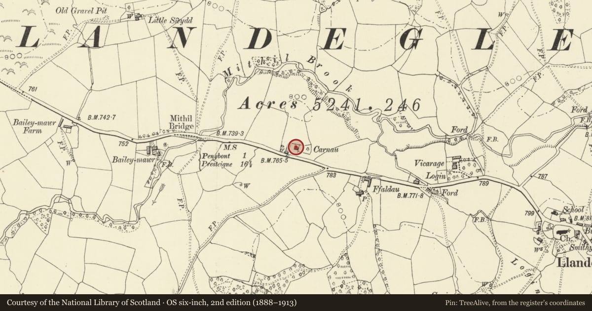
5 historical maps cover this location, the earliest the 1608 map "(13) Cambriae Typus." (David Rumsey Map Collection, Stanford Libraries).
Historical maps covering this location
- 1608 · (13) Cambriae Typus. (David Rumsey Map Collection, Stanford Libraries)
- 1637 · Particular description of Wales. Cambria seu Wallia (David Rumsey Map Collection, Stanford Libraries)
- 1883 · Watershed map England, Wales 3. (David Rumsey Map Collection, Stanford Libraries)
- 1899 · 180 Knighton (Hills) (David Rumsey Map Collection, Stanford Libraries)
- 1901 · Sheet 14. (David Rumsey Map Collection, Stanford Libraries)
Cadw's description
Location
Lies about 1.2 km (0.75 mile) NW of Llandegley village, set back from main road.
History
Early C18, front roof-line raised in C19, modern extension at west end and modern lean-to porch.
Exterior
Two storeys, single pile, rubble stone, slate roof, tall squared end stack to right with decorative oversailing courses. Small, two-light, timber casement windows probably in their original openings.
Interior
Good quality C18 features with much structural ornamentation. Large open fireplace with chamfered timber lintel and later brick-lined bread oven. Chamfered and scroll-stopped beams and exposed joists, moulded brackets supporting beam ends. Substantial stud-wall partitions with chamfered and moulded door frames, one ornate timber door head has been reset in a doorway, now blocked, in the rear wall. First-floor door frames are chamfered with mason's mitres. Heavy boarded doors hung on gudgeon pins, some original window openings have chamfered and stopped lintels and scratch moulded cills. Unusual framed staircase has panelled string with lozenge decoration, scratch moulded newel posts and hand rails, flat barley-twist balusters and carved brackets on the underside.
Reason for designation
Included on account of unusually fine internal detailing from early C18.
Nearby in the register
- FfaldauDomesticunder 1 mi
- GraigDomesticunder 1 mi
- Outbuilding range 30m SW of GraigAgriculture and Subsistenceunder 1 mi
- Little GraigDomesticunder 1 mi
Other entries of the same register within about three miles of this one, by straight line.