Cof Cymru: National Historic Assets of Wales · Wales
Tan-llan (The White Cottage)
Llanfihangel Glyn Myfyr, Conwy, Wales
A Grade II listed building in Llanfihangel, Llanfihangel Glyn Myfyr, Conwy, designated on 23 June 1967.
The record
- Designation
- Listed building, Grade II
- Broad class
- Domestic
- Date of designation
- 23 June 1967
- Locality
- Llanfihangel
- Community
- Llanfihangel Glyn Myfyr
- Unitary authority
- Conwy
- Country
- Wales
- Coordinates
- 53.03229, -3.50835
- Cadw reference
- 93
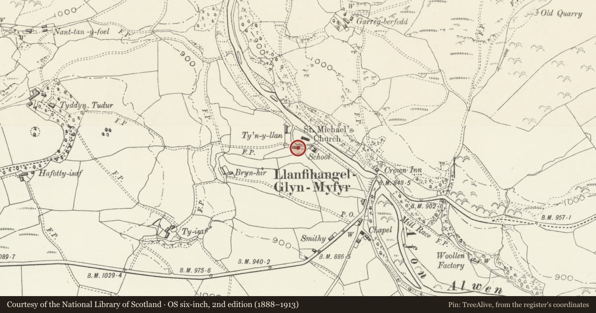
Slide toward Today to fade the historical sheet and see the modern map underneath.
David Rumsey Map Collection, Stanford LibrariesDavid Rumsey Map Collection, Stanford LibrariesLlyfrgell Genedlaethol Cymru – The National Library of WalesDavid Rumsey Map Collection, Stanford LibrariesDavid Rumsey Map Collection, Stanford Libraries
5 historical maps cover this location, the earliest the 1795 map "To Sir Watkin Williams-Wynn Bart ... the map of the six counties of North Wales is most humbly inscribed by his obedient humble servant" (Llyfrgell Genedlaethol Cymru – The National Library of Wales).
Historical maps covering this location
- 1795 · To Sir Watkin Williams-Wynn Bart ... the map of the six counties of North Wales is most… (Llyfrgell Genedlaethol Cymru – The National Library of Wales)
- 1830 · V.3:11-15:XV. Britisches Reich. A. Kon: England. b. Frstenthum Wales: Shire: 37-40 (David Rumsey Map Collection, Stanford Libraries)
- 1883 · Watershed map England, Wales 3. (David Rumsey Map Collection, Stanford Libraries)
- 1898 · 120 Corwen (Hills) (David Rumsey Map Collection, Stanford Libraries)
- 1901 · Sheet 9 and 10. (David Rumsey Map Collection, Stanford Libraries)
Cadw's description
Location
The house lies directly opposite the church, on the S side of the road running W and N from the centre of the village to Pentre-llyn-cymmer.
History
The house is probably C17 in origin, altered in the C20.
Exterior
Whitewashed rubble with a slate roof. Two bays, with gable stacks, extended to the E by a further bay, possibly contemporary, with a part-external gable stack. Lean-to on the N side against the road, a conservatory added on the S side, and a new W porch of 1997. Paned timber windows with oak lintels, but a 3-light timber window with transome to the centre bay, the upper lights paned, and the centre an iron hinged casement. Other windows altered, and roof lights. On the S side, two gabled dormer windows.
Reason for designation
Included largely for group value with the Church of St Michael.
Nearby in the register
- Church of St MichaelReligious, Ritual and Funeraryunder 1 mi
- The Crown Inn and stable buildingDomesticunder 1 mi
- Pont LlanfihangelTransportunder 1 mi
- The Old Rectory also known as PennantDomesticunder 1 mi
Other entries of the same register within about three miles of this one, by straight line.