Cof Cymru: National Historic Assets of Wales · Wales
4A Upper Clwyd Street
Ruthin, Denbighshire, Wales
A Grade II listed building in Upper Clwyd Street, Ruthin, Denbighshire, designated on 16 May 1978.
The record
- Designation
- Listed building, Grade II
- Broad class
- Commercial
- Date of designation
- 16 May 1978
- Locality
- Upper Clwyd Street
- Town
- Ruthin
- Community
- Ruthin
- Unitary authority
- Denbighshire
- Country
- Wales
- Coordinates
- 53.11426, -3.31110
- Cadw reference
- 926
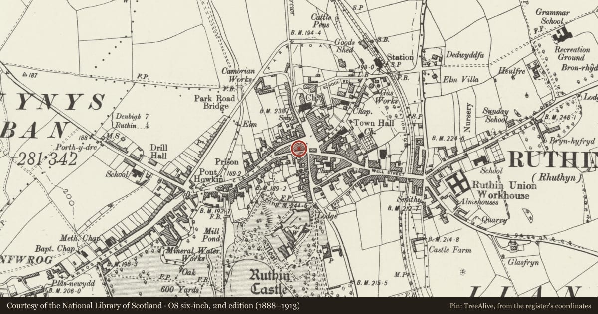
Slide toward Today to fade the historical sheet and see the modern map underneath.
David Rumsey Map Collection, Stanford LibrariesDavid Rumsey Map Collection, Stanford LibrariesDavid Rumsey Map Collection, Stanford LibrariesLlyfrgell Genedlaethol Cymru – The National Library of WalesDavid Rumsey Map Collection, Stanford Libraries
5 historical maps cover this location, the earliest the 1795 map "To Sir Watkin Williams-Wynn Bart ... the map of the six counties of North Wales is most humbly inscribed by his obedient humble servant" (Llyfrgell Genedlaethol Cymru – The National Library of Wales).
Historical maps covering this location
- 1795 · To Sir Watkin Williams-Wynn Bart ... the map of the six counties of North Wales is most… (Llyfrgell Genedlaethol Cymru – The National Library of Wales)
- 1883 · Watershed map England, Wales 3. (David Rumsey Map Collection, Stanford Libraries)
- 1898 · 108 Flint (Hills) (David Rumsey Map Collection, Stanford Libraries)
- 1898 · 108 Flint (Outline) (David Rumsey Map Collection, Stanford Libraries)
- 1901 · Sheet 9 and 10. (David Rumsey Map Collection, Stanford Libraries)
Cadw's description
Location
In a slightly raised position above the road, which slopes down towards the W.
History
C18 or earlier, and of the same build as No 2 & 2A, but re-fronted in brick in the early C19. Shop fronts to ground floor and basement. In 1899, No 4A was a printers, stationers and newsagents, the shop-front now renewed. No 4 has advanced wing, probably an addition of the early C19.
Exterior
4A & 4 form a group. 4A is to the R, 4 to the L.
Three-window range of one-and-a-half-storeys, with projecting cross-wing to L with half-hipped roof; basement storey to L. Constructed of red brick under a slate roof, with brick end stack to R, and ridge stack to L, at junction with cross-wing. Terraced walkway from R, leading to entrances, the lower part of rubble stone, the upper part rebuilt in late C20 blockwork.
No 4A is main range, with 3 gabled half-dormers to upper storey, containing wooden cross-windows with quarry glazing. Ground floor has similar 3-light window to L, under a tall cambered brick head. Inserted late C20 shop-front to R, with glazed door to far R. Large projecting shop window, 3-light over wooden boarding under a flat roof. Basement to L has rectangular opening for a shop, cut into terrace retaining wall: inset splayed entrance with half-glazed boarded door flanked by plain-glazed windows.
Interior
Interior not seen.
Reason for designation
Listed, notwithstanding alterations to detail, for retention of its sub-medieval plan-form and good C19 brick front. Group value with surrounding listed buildings in Upper Clwyd Street.
Nearby in the register
- 2A Upper Clwyd StreetNo class recordedunder 1 mi
- 4 Upper Clwyd StreetNo class recordedunder 1 mi
- Siop LlyfrCommercialunder 1 mi
- 2 Upper Clwyd StreetCommercialunder 1 mi
Other entries of the same register within about three miles of this one, by straight line.