Cof Cymru: National Historic Assets of Wales · Wales
Wayside Cottage
New Radnor, Powys, Wales
A Grade II listed building in New Radnor, Powys, designated on 29 April 1993.
The record
- Designation
- Listed building, Grade II
- Broad class
- Domestic
- Date of designation
- 29 April 1993
- Community
- New Radnor
- Unitary authority
- Powys
- Country
- Wales
- Coordinates
- 52.24050, -3.15679
- Cadw reference
- 9223
Slide toward Today to fade the historical sheet and see the modern map underneath.
David Rumsey Map Collection, Stanford LibrariesDavid Rumsey Map Collection, Stanford LibrariesDavid Rumsey Map Collection, Stanford LibrariesDavid Rumsey Map Collection, Stanford LibrariesDavid Rumsey Map Collection, Stanford Libraries
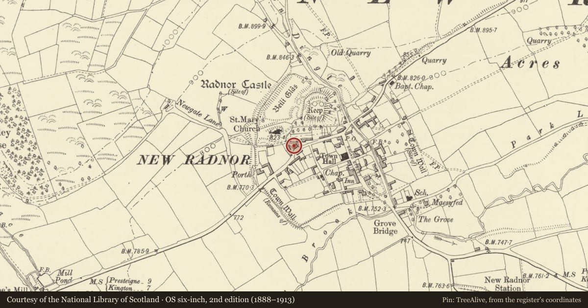
5 historical maps cover this location, the earliest the 1608 map "(13) Cambriae Typus." (David Rumsey Map Collection, Stanford Libraries).
Historical maps covering this location
- 1608 · (13) Cambriae Typus. (David Rumsey Map Collection, Stanford Libraries)
- 1637 · Particular description of Wales. Cambria seu Wallia (David Rumsey Map Collection, Stanford Libraries)
- 1883 · Watershed map England, Wales 3. (David Rumsey Map Collection, Stanford Libraries)
- 1899 · 180 Knighton (Hills) (David Rumsey Map Collection, Stanford Libraries)
- 1901 · Sheet 14. (David Rumsey Map Collection, Stanford Libraries)
Cadw's description
Location
On the road, stepped down to left of No 9 (Wayside).
History
c1850, former service wing to adjoining house (Wayside).
Exterior
Two storeys, coursed rubble, hipped slate roof, brick paired-flue stack. Six-panel door under flat voussoir head, large C20 multi-paned window to front left under timber lintel, first-floor windows twenty-pane sashes.
Reason for designation
Included for group value with Wayside.
Nearby in the register
- WaysideDomesticunder 1 mi
- 10 High StreetDomesticunder 1 mi
- 11 High StreetDomesticunder 1 mi
- 9 Church StreetDomesticunder 1 mi
Other entries of the same register within about three miles of this one, by straight line.