Cof Cymru: National Historic Assets of Wales · Wales
T-Plan Range of outbuildings attached to Siluria
Old Radnor, Powys, Wales
A Grade II listed building in Yardro, Old Radnor, Powys, designated on 15 February 1993.
The record
- Designation
- Listed building, Grade II
- Broad class
- Domestic
- Date of designation
- 15 February 1993
- Locality
- Yardro
- Community
- Old Radnor
- Unitary authority
- Powys
- Country
- Wales
- Coordinates
- 52.22188, -3.13228
- Cadw reference
- 9202
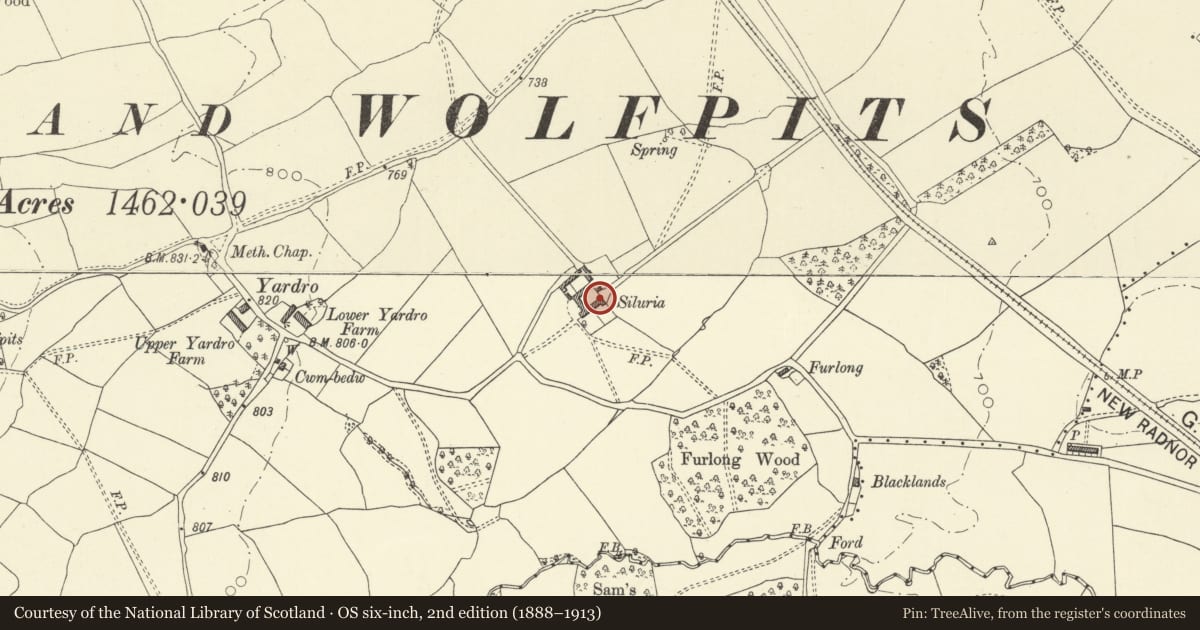
Slide toward Today to fade the historical sheet and see the modern map underneath.
David Rumsey Map Collection, Stanford LibrariesDavid Rumsey Map Collection, Stanford LibrariesDavid Rumsey Map Collection, Stanford LibrariesDavid Rumsey Map Collection, Stanford LibrariesDavid Rumsey Map Collection, Stanford Libraries
5 historical maps cover this location, the earliest the 1608 map "(13) Cambriae Typus." (David Rumsey Map Collection, Stanford Libraries).
Historical maps covering this location
- 1608 · (13) Cambriae Typus. (David Rumsey Map Collection, Stanford Libraries)
- 1637 · Particular description of Wales. Cambria seu Wallia (David Rumsey Map Collection, Stanford Libraries)
- 1883 · Watershed map England, Wales 3. (David Rumsey Map Collection, Stanford Libraries)
- 1898 · 197 Hay (Hills) (David Rumsey Map Collection, Stanford Libraries)
- 1901 · Sheet 14. (David Rumsey Map Collection, Stanford Libraries)
Cadw's description
Location
Reached along by-way running S from Harpton to Yardro road, Siluria is about 0.75km from both locations.
History
Early C19, replacing earlier dwelling.
Exterior
Two storeys with contemporary one-and-a-half storey service wing under rear catslide roof; further late C19 lean-to extension. Coursed squared rubble, of better quality to front elevation, slate roofs, 2 projecting rubble end stacks. Three-window front, timber cross-pattern frames with central-opening iron casements under cambered voussoir lintels. Upper windows have offset gablets above. Rubble porch with pitched roof and tall arched entrance, arched opening to door, part-glazed 4-panel door under fanlight with intersecting tracery.
Running north-east from the gable end of the house, contemporary 2-storey T-plan range of cowhouses and stables. Coursed rubble, cambered voussoir lintels, ventilation slits, slate roof. Tall arched entrances to passageway running between stables and house.
Nearby in the register
- SiluriaDomesticunder 1 mi
- Courtyard Ranges of Farm Buildings to North of SiluriaAgriculture and Subsistenceunder 1 mi
- Detached Privy 20m W of Siluria FarmhouseDomesticunder 1 mi
- Yardro Chapel (Calvinistic Methodist)Religious, Ritual and Funeraryunder 1 mi
Other entries of the same register within about three miles of this one, by straight line.