Cof Cymru: National Historic Assets of Wales · Wales
Former Station Building close to junction with A44 (Powys County Store)
Old Radnor, Powys, Wales
A Grade II listed building in Stanner, Old Radnor, Powys, designated on 15 February 1993.
The record
- Designation
- Listed building, Grade II
- Broad class
- Transport
- Date of designation
- 15 February 1993
- Locality
- Stanner
- Community
- Old Radnor
- Unitary authority
- Powys
- Country
- Wales
- Coordinates
- 52.21724, -3.08253
- Cadw reference
- 9190
Slide toward Today to fade the historical sheet and see the modern map underneath.
David Rumsey Map Collection, Stanford LibrariesDavid Rumsey Map Collection, Stanford LibrariesDavid Rumsey Map Collection, Stanford LibrariesDavid Rumsey Map Collection, Stanford LibrariesDavid Rumsey Map Collection, Stanford Libraries
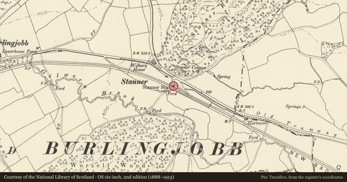
5 historical maps cover this location, the earliest the 1608 map "(13) Cambriae Typus." (David Rumsey Map Collection, Stanford Libraries).
Historical maps covering this location
- 1608 · (13) Cambriae Typus. (David Rumsey Map Collection, Stanford Libraries)
- 1637 · Particular description of Wales. Cambria seu Wallia (David Rumsey Map Collection, Stanford Libraries)
- 1883 · Watershed map England, Wales 3. (David Rumsey Map Collection, Stanford Libraries)
- 1898 · 197 Hay (Hills) (David Rumsey Map Collection, Stanford Libraries)
- 1901 · Sheet 14. (David Rumsey Map Collection, Stanford Libraries)
Cadw's description
Location
Situated on wedge of ground between B4594 and A44 from Kington to Walton.
Exterior
Served New Radnor branch of the Kington/Eardisley Railway which opened September 1875.
Simple, single unit plan with lean-to on right. Rockfaced rubble, plinth course, cambered voussoir lintels, shallow-pitch slate roof, crested ridge, decorative pierced barge and eaves boards, brick end stack with ornamental clay pot. Former platform side has wide central entrance with panelled double doors, flanking cross-pattern windows, deep-set with stone cills. Opposite windows to rear wall, narrow boarded doors to WCs in lean-to, each with small square window. Internal plan of waiting room with fireplace and booking office with stove.
Reason for designation
A well-preserved example of a small rural station building, currently in use as County Highways Department store.
Nearby in the register
- Worsell Wood cairn cemeteryRound Cairnunder 1 mi
- Bilmore FarmhouseDomesticunder 1 mi
- Lower Hanter, including continuous Agricultural Range to rightDomesticunder 1 mi
- Old Radnor CastleMoated Siteunder 1 mi
Other entries of the same register within about three miles of this one, by straight line.