Cof Cymru: National Historic Assets of Wales · Wales
The Harp Inn
Old Radnor, Powys, Wales
A Grade II listed building in Old Radnor, Powys, designated on 15 February 1993.
The record
- Designation
- Listed building, Grade II
- Broad class
- Commercial
- Date of designation
- 15 February 1993
- Community
- Old Radnor
- Unitary authority
- Powys
- Country
- Wales
- Coordinates
- 52.22523, -3.09881
- Cadw reference
- 9132
Slide toward Today to fade the historical sheet and see the modern map underneath.
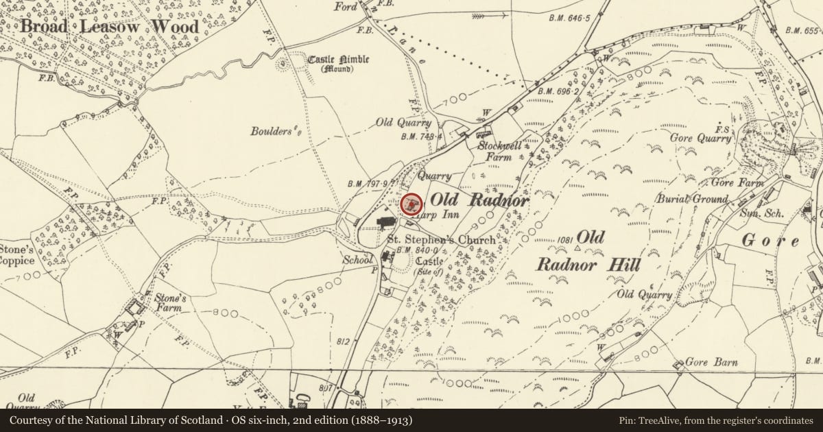
David Rumsey Map Collection, Stanford LibrariesDavid Rumsey Map Collection, Stanford LibrariesDavid Rumsey Map Collection, Stanford LibrariesDavid Rumsey Map Collection, Stanford LibrariesDavid Rumsey Map Collection, Stanford Libraries
5 historical maps cover this location, the earliest the 1608 map "(13) Cambriae Typus." (David Rumsey Map Collection, Stanford Libraries).
Historical maps covering this location
- 1608 · (13) Cambriae Typus. (David Rumsey Map Collection, Stanford Libraries)
- 1637 · Particular description of Wales. Cambria seu Wallia (David Rumsey Map Collection, Stanford Libraries)
- 1883 · Watershed map England, Wales 3. (David Rumsey Map Collection, Stanford Libraries)
- 1898 · 197 Hay (Hills) (David Rumsey Map Collection, Stanford Libraries)
- 1901 · Sheet 14. (David Rumsey Map Collection, Stanford Libraries)
Cadw's description
Location
Sited below Old Radnor Hill and 200m NE of St Stephen's Church.
History
C16/17. Former cross-passage timber-framed house, walls rebuilt in rubble stone, former byre/barn end rebuilt and converted to domestic use by the Landmark Trust in 1971.
Exterior
Two storeys, attic and cellar, rear extensions under catslide roofs with modern flat-roofed dormers. Stone tile roof, ridge stack and offset end stack in modern brick. Boarded door to front left. C19 cross-pattern chamfered-frame windows with metal casements to the original portion.
Interior
Large panel timber-framing exposed on rear wall and to partition wall to right of former cross-passage. Latter partition mainly cut through on ground floor but one chamfered and stopped door-frame survives. Ground floor left-hand end room has scroll-stopped beams and large rubble-lined fireplace with brick bread oven. Stone flagged floors throughout. Exposed beam with deep chamfer and step stop on first floor.
Reason for designation
Group value in fine landscape setting with Parish Church.
Nearby in the register
- Parish Church of St StephenReligious, Ritual and Funeraryunder 1 mi
- Old Radnor CastleMoated Siteunder 1 mi
- Telephone Call-box 75m SW of St Stephen's ChurchCommunicationsunder 1 mi
- Stockwell Farmhouse, including attached Ranges to SouthDomesticunder 1 mi
Other entries of the same register within about three miles of this one, by straight line.