Cof Cymru: National Historic Assets of Wales · Wales
Yew Tree Farmhouse
Whitton, Powys, Wales
A Grade II listed building in Discoed, Whitton, Powys, designated on 16 March 1992.
The record
- Designation
- Listed building, Grade II
- Broad class
- Domestic
- Date of designation
- 16 March 1992
- Locality
- Discoed
- Community
- Whitton
- Unitary authority
- Powys
- Country
- Wales
- Coordinates
- 52.27933, -3.06975
- Cadw reference
- 9096
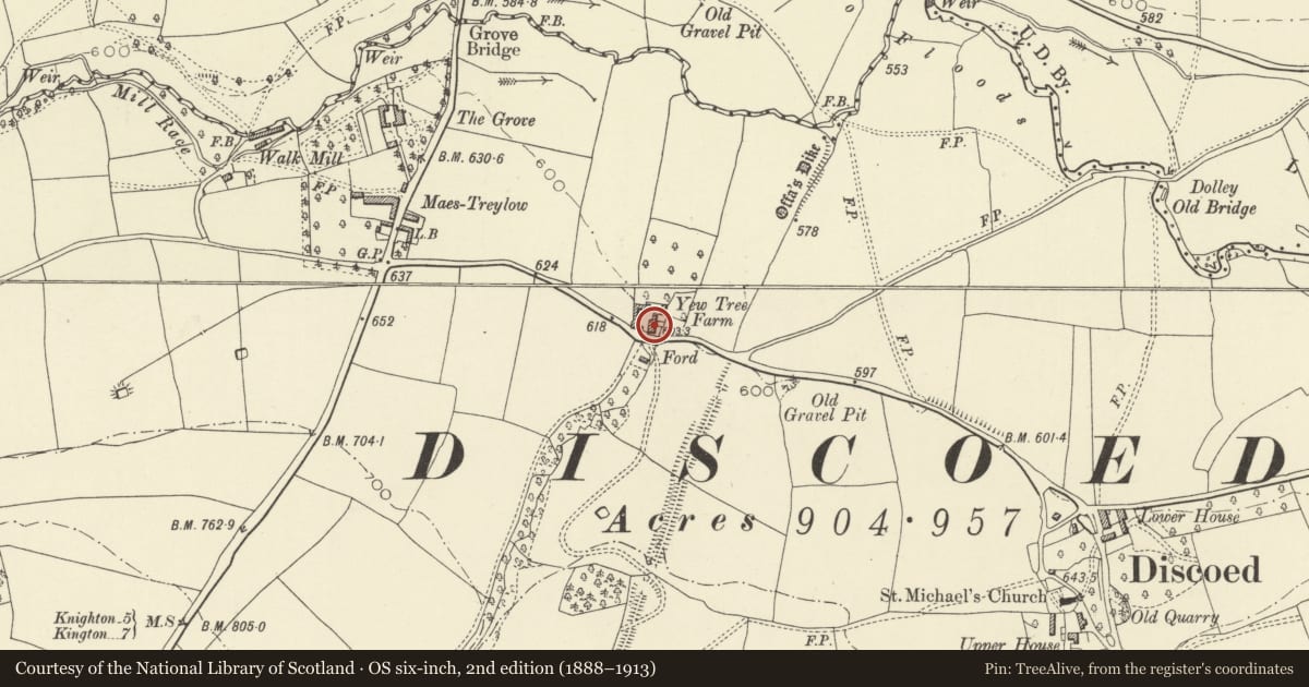
Slide toward Today to fade the historical sheet and see the modern map underneath.
David Rumsey Map Collection, Stanford LibrariesDavid Rumsey Map Collection, Stanford LibrariesDavid Rumsey Map Collection, Stanford LibrariesDavid Rumsey Map Collection, Stanford LibrariesDavid Rumsey Map Collection, Stanford Libraries
5 historical maps cover this location, the earliest the 1608 map "(13) Cambriae Typus." (David Rumsey Map Collection, Stanford Libraries).
Historical maps covering this location
- 1608 · (13) Cambriae Typus. (David Rumsey Map Collection, Stanford Libraries)
- 1637 · Particular description of Wales. Cambria seu Wallia (David Rumsey Map Collection, Stanford Libraries)
- 1883 · Watershed map England, Wales 3. (David Rumsey Map Collection, Stanford Libraries)
- 1899 · 180 Knighton (Hills) (David Rumsey Map Collection, Stanford Libraries)
- 1901 · Sheet 14. (David Rumsey Map Collection, Stanford Libraries)
Cadw's description
Location
Sited down the slope, quarter of a mile east of Discoed crossroads.
History
Medieval in origin, much evidence of rebuilding, C19 remodelling.
Exterior
Two storey, four bay, single pile house, the right hand bay recessed about 1ft. Painted rubble stone, slate roof, tall brick stacks projecting from front and rear eaves and roadside gable end. Door to left of centre part glazed under open timber porch. Irregular windows mainly C19/20 casements, rear elevation has regular arrangement of C19 chamfered casements.
Interior
Retains former plan with cross-passage and major trusses above room partitions. Three cruck trusses survive, the upper sections are visible in the roof space, one is infilled and smoke-blackened both sides with a mortice and tenon yoke and central post. C19 king-post roof built above. Ground floor room to south of hall passage has two C17 scroll-stopped axial beams.
Reason for designation
Included in the list for its surviving medieval features and because it forms an attractive roadside grouping with its outbuildings.
Nearby in the register
- Outbuilding at Yew Treet FarmAgriculture and Subsistenceunder 1 mi
- Farm Range at Maes TreylowAgriculture and Subsistenceunder 1 mi
- Maes TreylowDomesticunder 1 mi
- The WalkmillIndustrialunder 1 mi
Other entries of the same register within about three miles of this one, by straight line.