Cof Cymru: National Historic Assets of Wales · Wales
Llanshay Farmhouse
Knighton, Powys, Wales
A Grade II listed building in Llanshay, Knighton, Powys, designated on 30 September 1985.
The record
- Designation
- Listed building, Grade II
- Broad class
- Domestic
- Date of designation
- 30 September 1985
- Locality
- Llanshay
- Community
- Knighton
- Unitary authority
- Powys
- Country
- Wales
- Coordinates
- 52.34007, -3.03327
- Cadw reference
- 9034
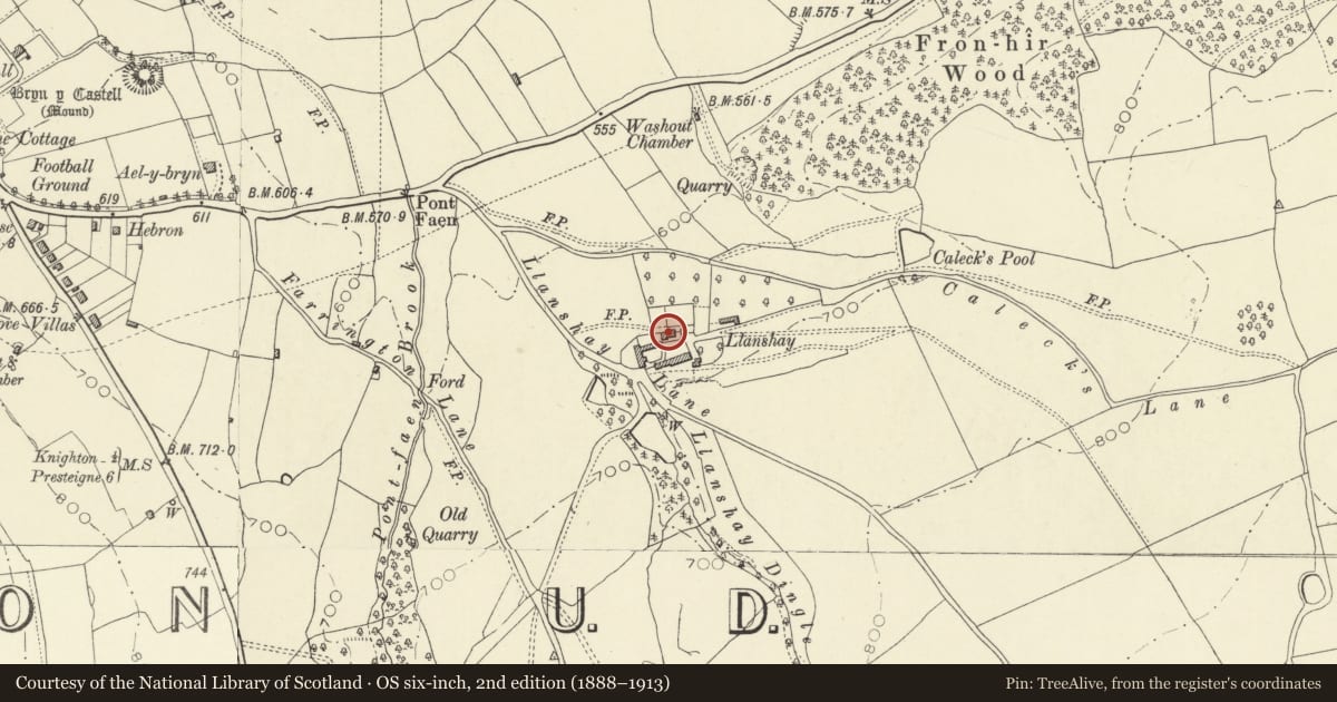
Slide toward Today to fade the historical sheet and see the modern map underneath.
David Rumsey Map Collection, Stanford LibrariesDavid Rumsey Map Collection, Stanford LibrariesDavid Rumsey Map Collection, Stanford LibrariesDavid Rumsey Map Collection, Stanford LibrariesDavid Rumsey Map Collection, Stanford Libraries
5 historical maps cover this location, the earliest the 1637 map "Particular description of Wales. Cambria seu Wallia" (David Rumsey Map Collection, Stanford Libraries).
Historical maps covering this location
- 1637 · Particular description of Wales. Cambria seu Wallia (David Rumsey Map Collection, Stanford Libraries)
- 1830 · V.3:11-15:XV.Britisches Reich. A. Kon: England. a. England ab sich: Shire:15-17, 33 (David Rumsey Map Collection, Stanford Libraries)
- 1883 · Watershed map England, Wales 3. (David Rumsey Map Collection, Stanford Libraries)
- 1899 · 180 Knighton (Hills) (David Rumsey Map Collection, Stanford Libraries)
- 1901 · Sheet 14. (David Rumsey Map Collection, Stanford Libraries)
Cadw's description
Location
Approximately 3/4 mile SE of Knighton, set back on an uphill site and facing south.
Exterior
Mainly C19 roughcast front to house with earlier, probably C15 and C17, interior and origins. 1-storey and attic with 2-storey cross range to left; 4+1 windows wide, mainly 2-light casements. Slate roof, exposed eaves, central roughcast stack and 3 pitched roof dormers with plain bargeboards.
C17 2-storey 1-window gable ended roughcast cross range (1 storey to rear) originally jettied but later underbuilt in stone. Roughcast stack to left. 1 storey and attic centre rear with modern dormers and later windows; brick walls on stone plinth, brick and roughcast stacks.
Interior
Interior of main range retains 3 cruck couples of probably C15 date (all sawn off below 1st floor level); thick uncusped blades set well in from rear wall as a result of later alterations when roof was heightened and broadened. Probably once an open hall, floored in C17 with feather - stop chamfer beams to main rooms. Fireplace with large timber lintel. Some timber partition walls visible as is the timber frame of the cross range.
Nearby in the register
- Long Barn to South of Llanshay FarmhouseAgriculture and Subsistenceunder 1 mi
- Bryn y CastellMotteunder 1 mi
- Downton Inlet HouseDomesticunder 1 mi
- TemesideDomesticunder 1 mi
Other entries of the same register within about three miles of this one, by straight line.