Cof Cymru: National Historic Assets of Wales · Wales
The Old Workshop (formerly Knighton Baptist Chapel)
Knighton, Powys, Wales
A Grade II listed building in Knighton, Powys, designated on 3 May 1985.
The record
- Designation
- Listed building, Grade II
- Broad class
- Commercial
- Date of designation
- 3 May 1985
- Town
- Knighton
- Community
- Knighton
- Unitary authority
- Powys
- Country
- Wales
- Coordinates
- 52.34408, -3.04697
- Cadw reference
- 9023
Slide toward Today to fade the historical sheet and see the modern map underneath.
David Rumsey Map Collection, Stanford LibrariesDavid Rumsey Map Collection, Stanford LibrariesDavid Rumsey Map Collection, Stanford LibrariesDavid Rumsey Map Collection, Stanford LibrariesDavid Rumsey Map Collection, Stanford Libraries
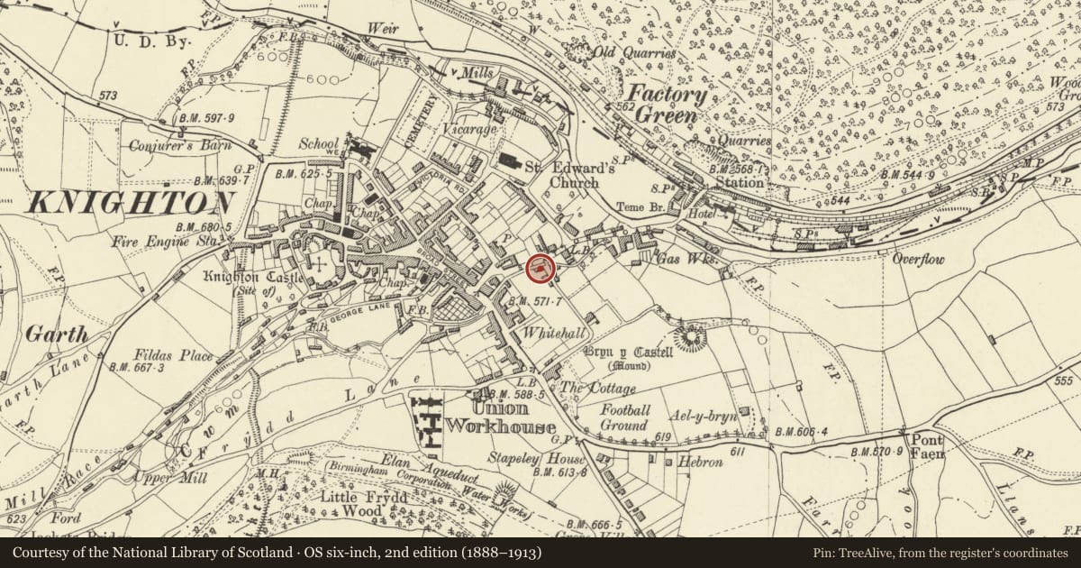
5 historical maps cover this location, the earliest the 1637 map "Particular description of Wales. Cambria seu Wallia" (David Rumsey Map Collection, Stanford Libraries).
Historical maps covering this location
- 1637 · Particular description of Wales. Cambria seu Wallia (David Rumsey Map Collection, Stanford Libraries)
- 1830 · V.3:11-15:XV.Britisches Reich. A. Kon: England. a. England ab sich: Shire:15-17, 33 (David Rumsey Map Collection, Stanford Libraries)
- 1883 · Watershed map England, Wales 3. (David Rumsey Map Collection, Stanford Libraries)
- 1899 · 180 Knighton (Hills) (David Rumsey Map Collection, Stanford Libraries)
- 1901 · Sheet 14. (David Rumsey Map Collection, Stanford Libraries)
Cadw's description
Location
At corner of Station Road and Bowling Green Lane with Cwm Brook running below main front.
History
C18 or early C19 2-storey former agricultural building, later converted to chapel use.
Exterior
White rendered upper floor with crossgable to long front: coursed rubble ground floor. Weatherboarding to right and upper floor of left gables and to rear. Brick jambs to side entrance. Slate roof, plain eaves and bargeboards; no chimneys. 4 windows wide - mixture of hopper type and sash and casement, 2- and 3-light. 4-light segmental window with timber margin and keystone under central gable. Below and to either side, 2 boarded doors (one blocked), formally flanking pulpit within. Bridging now removed. Small attic window above a boarded loft opening to left gable.
Ground floor entrance doors. Iron railings by stream.
Building disused at time of inspection (April 1985).
Interior
Interior retains original simple tiebeam roof with angled braces, overlapping purlins mostly replaced. Timber beams with wall brackets to main floor.
Reason for designation
Group value.
Nearby in the register
- StreamfordDomesticunder 1 mi
- 2 Bowling Green LaneDomesticunder 1 mi
- Horse and Jockey P.H.Commercialunder 1 mi
- Burford HouseDomesticunder 1 mi
Other entries of the same register within about three miles of this one, by straight line.