Cof Cymru: National Historic Assets of Wales · Wales
Boundary Railings in front of Moelfa & 1-14
Ruthin, Denbighshire, Wales
A Grade II listed building in Ruthin, Denbighshire, designated on 16 May 1978.
The record
- Designation
- Listed building, Grade II
- Broad class
- Gardens, Parks and Urban Spaces
- Date of designation
- 16 May 1978
- Town
- Ruthin
- Community
- Ruthin
- Unitary authority
- Denbighshire
- Country
- Wales
- Coordinates
- 53.11401, -3.30615
- Cadw reference
- 899
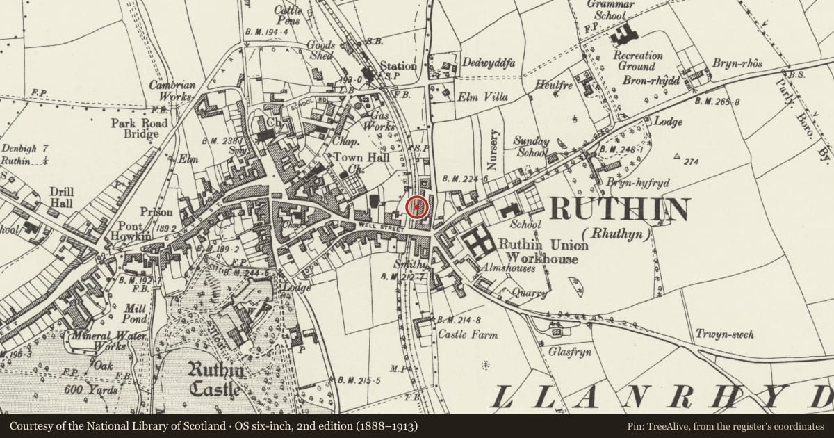
Slide toward Today to fade the historical sheet and see the modern map underneath.
David Rumsey Map Collection, Stanford LibrariesDavid Rumsey Map Collection, Stanford LibrariesDavid Rumsey Map Collection, Stanford LibrariesLlyfrgell Genedlaethol Cymru – The National Library of WalesDavid Rumsey Map Collection, Stanford Libraries
5 historical maps cover this location, the earliest the 1795 map "To Sir Watkin Williams-Wynn Bart ... the map of the six counties of North Wales is most humbly inscribed by his obedient humble servant" (Llyfrgell Genedlaethol Cymru – The National Library of Wales).
Historical maps covering this location
- 1795 · To Sir Watkin Williams-Wynn Bart ... the map of the six counties of North Wales is most… (Llyfrgell Genedlaethol Cymru – The National Library of Wales)
- 1883 · Watershed map England, Wales 3. (David Rumsey Map Collection, Stanford Libraries)
- 1898 · 108 Flint (Hills) (David Rumsey Map Collection, Stanford Libraries)
- 1898 · 108 Flint (Outline) (David Rumsey Map Collection, Stanford Libraries)
- 1901 · Sheet 9 and 10. (David Rumsey Map Collection, Stanford Libraries)
Cadw's description
Location
Bounding the footpath which provides access to Moelfa and 1-14, and retaining it above the line of the former railway to the W.
History
Built as part of the Railway Terrace scheme, which is dated 1864; fronting the former Vale of Clwyd Railway.
Exterior
Fronting Railway Terrace and bounding a footpath which leads to the front doors of the cottages. The ground falls sharply towards the N, the boundary acting as a retaining wall from No 5 onwards.
Rubble stone wall with dressed stone coping, supporting plain iron railings with spear finials, the main posts with decorative conical finials. Towards the N, where it is higher, the retaining wall has raked buttresses. It continues slightly beyond the N end of the terrace, where it steps down and has narrower railings in the same style.
Reason for designation
Listed as a prominent length of forecourt railings, little altered and retaining their character. Group value with Moelfa and 1-14 Railway Terrace.
Nearby in the register
- 7 Railway TerraceNo class recordedunder 1 mi
- 6 Railway TerraceNo class recordedunder 1 mi
- 8 Railway TerraceNo class recordedunder 1 mi
- 5 Railway TerraceNo class recordedunder 1 mi
Other entries of the same register within about three miles of this one, by straight line.