Cof Cymru: National Historic Assets of Wales · Wales
The Cottage
Presteigne, Powys, Wales
A Grade II listed building in Norton, Presteigne, Powys, designated on 26 March 1985.
The record
- Designation
- Listed building, Grade II
- Broad class
- Domestic
- Date of designation
- 26 March 1985
- Locality
- Norton
- Community
- Presteigne
- Unitary authority
- Powys
- Country
- Wales
- Coordinates
- 52.29497, -3.02131
- Cadw reference
- 8943
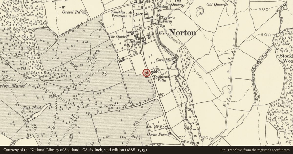
Slide toward Today to fade the historical sheet and see the modern map underneath.
David Rumsey Map Collection, Stanford LibrariesDavid Rumsey Map Collection, Stanford LibrariesDavid Rumsey Map Collection, Stanford LibrariesDavid Rumsey Map Collection, Stanford LibrariesDavid Rumsey Map Collection, Stanford Libraries
5 historical maps cover this location, the earliest the 1637 map "Particular description of Wales. Cambria seu Wallia" (David Rumsey Map Collection, Stanford Libraries).
Historical maps covering this location
- 1637 · Particular description of Wales. Cambria seu Wallia (David Rumsey Map Collection, Stanford Libraries)
- 1830 · V.3:11-15:XV.Britisches Reich. A. Kon: England. a. England ab sich: Shire:15-17, 33 (David Rumsey Map Collection, Stanford Libraries)
- 1883 · Watershed map England, Wales 3. (David Rumsey Map Collection, Stanford Libraries)
- 1899 · 180 Knighton (Hills) (David Rumsey Map Collection, Stanford Libraries)
- 1901 · Sheet 14. (David Rumsey Map Collection, Stanford Libraries)
Cadw's description
Location
By roadside. Similar Jacobethan style to Norton Manor.
History
About 1860, some alterations.
Exterior
2 storey, L-shapad ornamental cottage, rubble facings with freestone dressings, slate roofs with bargeboards and finials; small cross gable to advanced centre bay, stone stacks with tall diagonal brick stems. Three 2-light Tudor windows (3 light to rear) under rectangular dripmoulds with cruciform mullions and small-pane glazing. Pitched roof to solid porch with triangular head to doorway (window over has been altered).
Nearby in the register
- 6 The TerraceDomesticunder 1 mi
- 5 The TerraceDomesticunder 1 mi
- 4 The TerraceDomesticunder 1 mi
- Norton MillIndustrialunder 1 mi
Other entries of the same register within about three miles of this one, by straight line.