Cof Cymru: National Historic Assets of Wales · Wales
Broad Heath House
Presteigne, Powys, Wales
A Grade II listed building in Broad Heath, Presteigne, Powys, designated on 26 March 1985.
The record
- Designation
- Listed building, Grade II
- Broad class
- Domestic
- Date of designation
- 26 March 1985
- Locality
- Broad Heath
- Community
- Presteigne
- Unitary authority
- Powys
- Country
- Wales
- Coordinates
- 52.26664, -2.97473
- Cadw reference
- 8930
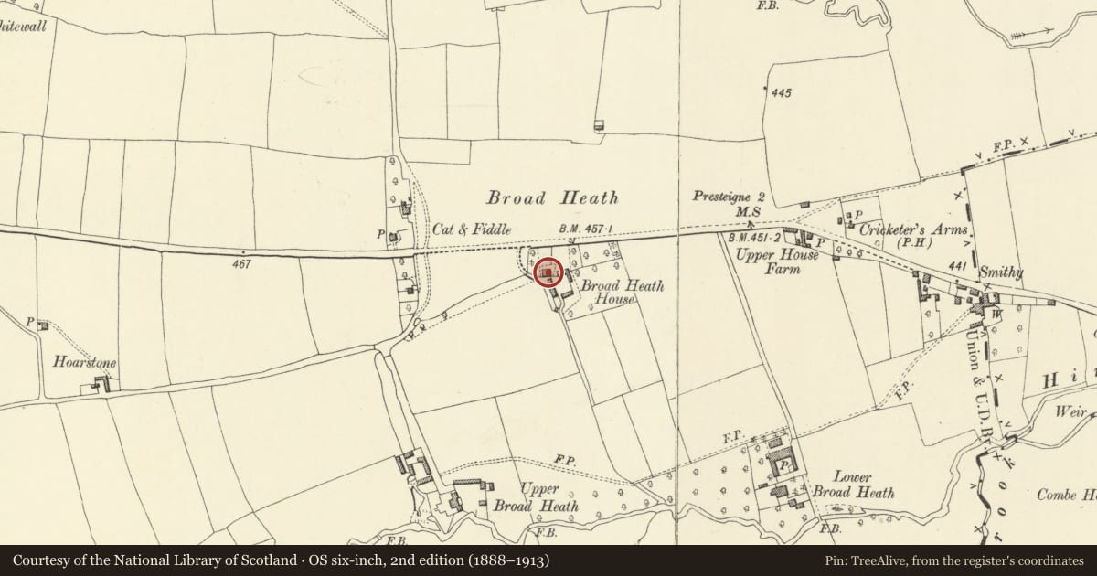
Slide toward Today to fade the historical sheet and see the modern map underneath.
David Rumsey Map Collection, Stanford LibrariesDavid Rumsey Map Collection, Stanford LibrariesDavid Rumsey Map Collection, Stanford LibrariesDavid Rumsey Map Collection, Stanford LibrariesDavid Rumsey Map Collection, Stanford Libraries
5 historical maps cover this location, the earliest the 1637 map "Particular description of Wales. Cambria seu Wallia" (David Rumsey Map Collection, Stanford Libraries).
Historical maps covering this location
- 1637 · Particular description of Wales. Cambria seu Wallia (David Rumsey Map Collection, Stanford Libraries)
- 1830 · V.3:11-15:XV.Britisches Reich. A. Kon: England. a. England ab sich: Shire:15-17, 33 (David Rumsey Map Collection, Stanford Libraries)
- 1883 · Watershed map England, Wales 3. (David Rumsey Map Collection, Stanford Libraries)
- 1899 · 180 Knighton (Hills) (David Rumsey Map Collection, Stanford Libraries)
- 1901 · Sheet 14. (David Rumsey Map Collection, Stanford Libraries)
Cadw's description
Location
In its own grounds with driveway to the south of the road.
History
C18 with later alterations, additions of about 1925 by Sir Clough Williams- Ellis.
Exterior
2 storey and attic, 3 window roughcast entrance front with small pediment over centre bay. Slate roof, end stacks, bracket cornices, ogee headed attic window in pediment, otherwise sashes with glazing bars in flush frames (plane reveals to ground floor windows). 6-panel door with fanlight under hood with slender supports.
2 storey extension with bipartite windows to left, further 1 storey extensions with stone slab roofs beyond.
Edwardian style (1925?) extension to right side facing driveway with circled treatment and balustraded openings. 2 storey rubble outbuilding with stone slab roof and weathervane to rear.
Nearby in the register
- Cat and FiddleCommercialunder 1 mi
- Upper Broad Heath FarmhouseDomesticunder 1 mi
- Lower Broad Heath FarmhouseDomesticunder 1 mi
- Wegnall CottageDomesticunder 1 mi
Other entries of the same register within about three miles of this one, by straight line.