Cof Cymru: National Historic Assets of Wales · Wales
Methodist Church and Hall
Presteigne, Powys, Wales
A Grade II listed building in Presteigne, Powys, designated on 26 March 1985.
The record
- Designation
- Listed building, Grade II
- Broad class
- Religious, Ritual and Funerary
- Date of designation
- 26 March 1985
- Community
- Presteigne
- Unitary authority
- Powys
- Country
- Wales
- Coordinates
- 52.27545, -3.00876
- Cadw reference
- 8921
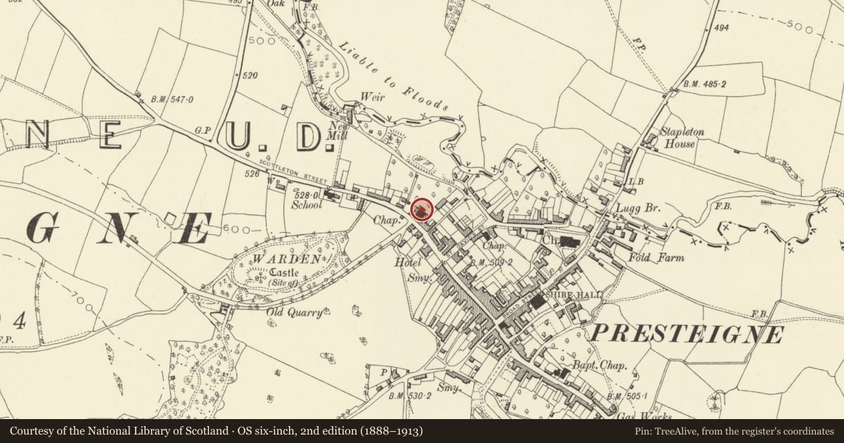
Slide toward Today to fade the historical sheet and see the modern map underneath.
David Rumsey Map Collection, Stanford LibrariesDavid Rumsey Map Collection, Stanford LibrariesDavid Rumsey Map Collection, Stanford LibrariesDavid Rumsey Map Collection, Stanford LibrariesDavid Rumsey Map Collection, Stanford Libraries
5 historical maps cover this location, the earliest the 1637 map "Particular description of Wales. Cambria seu Wallia" (David Rumsey Map Collection, Stanford Libraries).
Historical maps covering this location
- 1637 · Particular description of Wales. Cambria seu Wallia (David Rumsey Map Collection, Stanford Libraries)
- 1830 · V.3:11-15:XV.Britisches Reich. A. Kon: England. a. England ab sich: Shire:15-17, 33 (David Rumsey Map Collection, Stanford Libraries)
- 1883 · Watershed map England, Wales 3. (David Rumsey Map Collection, Stanford Libraries)
- 1899 · 180 Knighton (Hills) (David Rumsey Map Collection, Stanford Libraries)
- 1901 · Sheet 14. (David Rumsey Map Collection, Stanford Libraries)
Cadw's description
Location
Set back from the street with a walled and railed forecourt.
History
Dated 1867 (parchment scroll over doorway) and 1888 (hall). Built as Methodist Chapel (1867 inscription), later used as Primitive Methodist Church (1951 OS map).
Exterior
Simple Gothic gable end with advanced centre bay. Coursed rubble and freestone dressings, slate roof behind gable parapets with moulded kneelers and bracket eaves. Trefoil-headed lancet to gable over centrepiece flanked by buttresses with set-offs, ball-flower cornice. Y-traceried window over cusped centre doorway, hood moulds, boarded door strapwork hinges. Plain lancets to sides and flanked elevations, lozenge-pattern glazing with stained glass to centre window heads only. Lower gable end in similar style (dated 1888) to church hall on right, Sunday School attached to E end, blocked window in gable over.
Stone forecourt walls with pinnacled gatepiers, iron work railings and gate with quatrefoil motif.
Reason for designation
Group value.
Nearby in the register
- Warden ViewDomesticunder 1 mi
- Boundary Wall between Garage at No.2 and Coach House to Manor HouseDomesticunder 1 mi
- Bell HouseDomesticunder 1 mi
- Coach House to rear of Manor HouseDomesticunder 1 mi
Other entries of the same register within about three miles of this one, by straight line.