Cof Cymru: National Historic Assets of Wales · Wales
Milestone on Heol Morlais
Llannon, Carmarthenshire, Wales
A Grade II listed building in Llannon, Carmarthenshire.
The record
- Designation
- Listed building, Grade II
- Broad class
- Transport
- Welsh name
- Carreg filltir ar Heol Morlais
- Locality
- Llannon
- Community
- Llannon
- Unitary authority
- Carmarthenshire
- Country
- Wales
- Coordinates
- 51.75138, -4.11806
- Cadw reference
- 87967
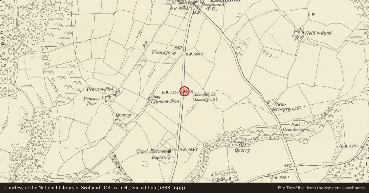
Slide toward Today to fade the historical sheet and see the modern map underneath.
David Rumsey Map Collection, Stanford LibrariesDavid Rumsey Map Collection, Stanford LibrariesDavid Rumsey Map Collection, Stanford LibrariesDavid Rumsey Map Collection, Stanford LibrariesDavid Rumsey Map Collection, Stanford Libraries
5 historical maps cover this location, the earliest the 1636 map "Cornubia : Devonia, Somersetus, Dorcestria, Wiltonia, Glocestria ..." (David Rumsey Map Collection, Stanford Libraries).
Historical maps covering this location
- 1636 · Cornubia : Devonia, Somersetus, Dorcestria, Wiltonia, Glocestria ... (David Rumsey Map Collection, Stanford Libraries)
- 1891 · Sheet 10. Ordnance Survey of England and Wales. . (David Rumsey Map Collection, Stanford Libraries)
- 1898 · 230 Ammanford (Hills) (David Rumsey Map Collection, Stanford Libraries)
- 1898 · 230 Ammanford (Outline) (David Rumsey Map Collection, Stanford Libraries)
- 1920 · Sheet 100. Llanelly. (David Rumsey Map Collection, Stanford Libraries)
Cadw's description
Location
On Heol Morlais section of A476 road, east side, opposite Erw Non housing.
History
The road from Llandeilo to Llanelly was part of the Three Commotts Turnpike Trust, created by a 1792 Act of Parliament.
Exterior
Milestone made of local limestone bearing the lettering: "F[rom] / LLANDILO / 12 Miles / To / LLANELLY / 5 ½ [Miles]". The top of the milestone, facing, is damaged or eroded. The stone is about 500mm high by about 350mm wide. The top is roughly rounded.
Reason for designation
Listed as a late C18 milestone of characteristic local type, one in a sequence of surviving milestones on this section of the turnpike road.
This building has been afforded Interim Protection under Section 79 of the Historic Environment (Wales) Act 2023. It is an offence to damage this structure and you may be prosecuted. To find out more about Interim Protection, please visit the statutory notices page on the Cadw website. For further information about this structure, or to report any damage please contact Cadw.
Nearby in the register
- The Old VicarageDomesticunder 1 mi
- Drinking FountainWater Supply and Drainageunder 1 mi
- The Old SchoolEducationunder 1 mi
- Church of St NonReligious, Ritual and Funeraryunder 1 mi
Other entries of the same register within about three miles of this one, by straight line.