Cof Cymru: National Historic Assets of Wales · Wales
Fingerpost at Ditchyeld Bridge, Walton
Old Radnor, Powys, Wales
A Grade II listed building in Walton, Old Radnor, Powys, designated on 7 November 2025.
The record
- Designation
- Listed building, Grade II
- Broad class
- Transport
- Date of designation
- 7 November 2025
- Welsh name
- Mynegbost ger pont Ditchyeld, Walton
- Locality
- Walton
- Community
- Old Radnor
- Unitary authority
- Powys
- Country
- Wales
- Coordinates
- 52.24017, -3.05627
- Cadw reference
- 87956
Slide toward Today to fade the historical sheet and see the modern map underneath.
David Rumsey Map Collection, Stanford LibrariesDavid Rumsey Map Collection, Stanford LibrariesDavid Rumsey Map Collection, Stanford LibrariesDavid Rumsey Map Collection, Stanford LibrariesDavid Rumsey Map Collection, Stanford Libraries
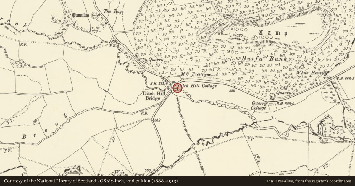
5 historical maps cover this location, the earliest the 1608 map "(13) Cambriae Typus." (David Rumsey Map Collection, Stanford Libraries).
Historical maps covering this location
- 1608 · (13) Cambriae Typus. (David Rumsey Map Collection, Stanford Libraries)
- 1637 · Particular description of Wales. Cambria seu Wallia (David Rumsey Map Collection, Stanford Libraries)
- 1883 · Watershed map England, Wales 3. (David Rumsey Map Collection, Stanford Libraries)
- 1899 · 180 Knighton (Hills) (David Rumsey Map Collection, Stanford Libraries)
- 1901 · Sheet 14. (David Rumsey Map Collection, Stanford Libraries)
Cadw's description
Location
On the S side of the B4362, 1¾ miles east of Walton, and opposite Ditchyeld Bridge.
History
Early C20 / inter-war finger post on the B4362.
Erected by Radnor County Council after the 1888 Local Government Act gave responsibility for roads to each County Council, Radnor County Council itself formed 1889. Perhaps replacing a milestone marked on the 1885 First Edition OS Map. The post likely post-dates the 1921 Ministry of Transport national road classification system, and the Ministry Circular directing the standardisation of signs in the same year.
Many fingerposts were removed in 1939-1941 in response to the threat of German invasion, more in the 1960s as design changed, and more again in the 1990s where they were considered a distraction to drivers, so this is a rare survivor.
Exterior
Cast iron fingerpost with three indicator arms. Banded black and white post, moulded capital and knuckle. Raised black lettering on white. Top arm point west with “WALTON 1¾ / NEW RADNOR 5”, middle arm points east marked “KNILL 1 / PRESTEIGNE 4” both with ‘B4362’ in a box above. Lower arm points north “BARLAND 1 / EVENJOBB 1½”. Post topped with annular inscribed ‘RADNOR CC’. No visible foundry marking.
Reason for designation
Included for its special architectural interest as a rare surviving example of an early C20 fingerpost, a type of street furniture once common but now increasingly rare. Group value with Ditchyeld Bridge (qv 9189).
Nearby in the register
- Ditchyeld BridgeTransportunder 1 mi
- Offa's Dyke: Section from Ditchyeld Bridge to County BoundaryLinear Earthworkunder 1 mi
- Offa's Dyke: Section extending 380m from BurfaLinear Earthworkunder 1 mi
- Burfa CampHillfortunder 1 mi
Other entries of the same register within about three miles of this one, by straight line.