Cof Cymru: National Historic Assets of Wales · Wales
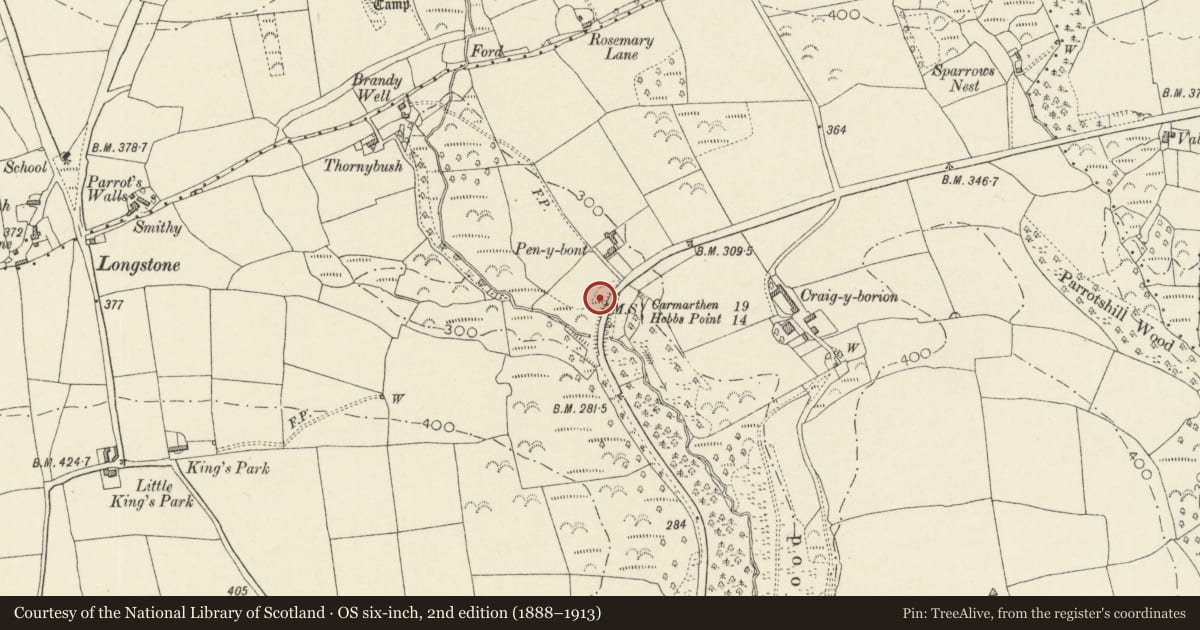
Milestone on A477, in the verge outside Pen-y-Bont Guest House
Amroth, Pembrokeshire, Wales
A Grade II listed building in Amroth, Pembrokeshire, designated on 30 June 2022.
The record
- Designation
- Listed building, Grade II
- Broad class
- No class recorded
- Date of designation
- 30 June 2022
- Welsh name
- Carreg filltir ar yr A477, y tu allan i westy Pen-y-Bont
- Community
- Amroth
- Unitary authority
- Pembrokeshire
- Country
- Wales
- Coordinates
- 51.75375, -4.67759
- Cadw reference
- 87867
Slide toward Today to fade the historical sheet and see the modern map underneath.
David Rumsey Map Collection, Stanford LibrariesDavid Rumsey Map Collection, Stanford LibrariesDavid Rumsey Map Collection, Stanford LibrariesDavid Rumsey Map Collection, Stanford LibrariesDavid Rumsey Map Collection, Stanford Libraries
5 historical maps cover this location, the earliest the 1636 map "Cornubia : Devonia, Somersetus, Dorcestria, Wiltonia, Glocestria ..." (David Rumsey Map Collection, Stanford Libraries).
Historical maps covering this location
- 1636 · Cornubia : Devonia, Somersetus, Dorcestria, Wiltonia, Glocestria ... (David Rumsey Map Collection, Stanford Libraries)
- 1637 · The fourth table of England. Cornub. Devonia, Somerset etc. (David Rumsey Map Collection, Stanford Libraries)
- 1891 · Sheet 10. Ordnance Survey of England and Wales. . (David Rumsey Map Collection, Stanford Libraries)
- 1898 · 228 Haverfordwest (Hills) (David Rumsey Map Collection, Stanford Libraries)
- 1901 · Sheet 13. (David Rumsey Map Collection, Stanford Libraries)
Cadw's description
Location
Situated in the verge outside Pen-y-Bont guest house, on the N side of the A477.
History
Milestone of 1838 on the Carmarthen to Pembroke Dock turnpike road, the cast-iron plaque cast by Moss & Sons of Carmarthen.
Exterior
Milestone, cast-iron plaque on stone or concrete. Canted front with two triangular-headed faces. On left: '19 miles to Carmarthen'. On right: '14 miles to Hobb's Point'.
Reason for designation
Included as a well-preserved example of a milestone, with special historic interest, as part of the earlier C19 turnpike system.
Nearby in the register
- Longstone CampEnclosureunder 1 mi
- East Limekiln at Kiln Park, BlaencilgoedIndustrialunder 1 mi
- Central Limekiln at Kiln Park, BlaencilgoedIndustrialunder 1 mi
- East Limekiln at Croft QuarriesIndustrialunder 1 mi
Other entries of the same register within about three miles of this one, by straight line.