Cof Cymru: National Historic Assets of Wales · Wales
Old Cottage in the grounds of Garth
Llanfair, Gwynedd, Wales
A Grade II listed building in Pensarn, Llanfair, Gwynedd, designated on 14 September 2020.
The record
- Designation
- Listed building, Grade II
- Broad class
- Domestic
- Date of designation
- 14 September 2020
- Welsh name
- Hen Fwthyn o fewn tir y Garth
- Locality
- Pensarn
- Community
- Llanfair
- Unitary authority
- Gwynedd
- Country
- Wales
- Coordinates
- 52.83200, -4.10466
- Cadw reference
- 87811
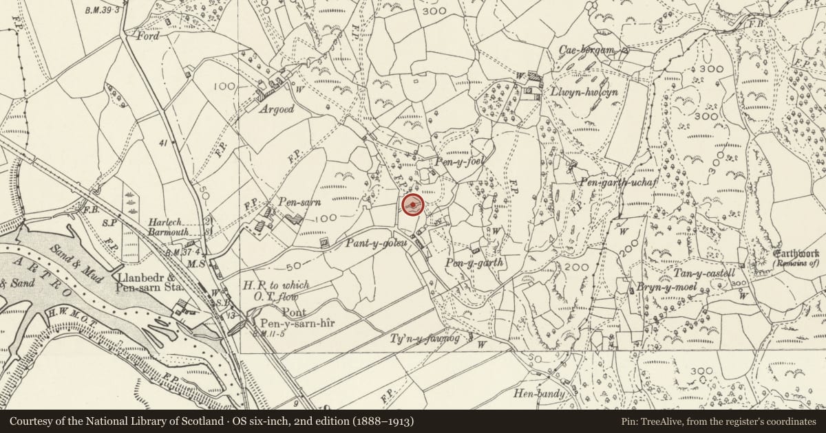
Slide toward Today to fade the historical sheet and see the modern map underneath.
David Rumsey Map Collection, Stanford LibrariesDavid Rumsey Map Collection, Stanford LibrariesDavid Rumsey Map Collection, Stanford LibrariesLlyfrgell Genedlaethol Cymru – The National Library of WalesDavid Rumsey Map Collection, Stanford Libraries
5 historical maps cover this location, the earliest the 1795 map "To Sir Watkin Williams-Wynn Bart ... the map of the six counties of North Wales is most humbly inscribed by his obedient humble servant" (Llyfrgell Genedlaethol Cymru – The National Library of Wales).
Historical maps covering this location
- 1795 · To Sir Watkin Williams-Wynn Bart ... the map of the six counties of North Wales is most… (Llyfrgell Genedlaethol Cymru – The National Library of Wales)
- 1883 · Watershed map England, Wales 3. (David Rumsey Map Collection, Stanford Libraries)
- 1896 · Sheet 7. Ordnance Survey of England and Wales. (David Rumsey Map Collection, Stanford Libraries)
- 1899 · 135 Harlech (Hills) (David Rumsey Map Collection, Stanford Libraries)
- 1901 · Sheet 9 and 10. (David Rumsey Map Collection, Stanford Libraries)
Cadw's description
Location
South-east of the house, which is reached up a short lane on the N side of a minor road E of the A496 at Pensarn.
History
Probably C18 and marked as a cottage, known as Garth, on the Llanfair Tithe map of 1839. It probably ceased to be a dwelling after a new house was built on the site, which is shown on the 1888 Ordnance Survey map.
Exterior
A single-storey double-fronted cottage built of rubble field stone, with slate-stone lintels, under a renewed slate roof behind coped gables, with stone stack to the Left. The boarded door is flanked by wood-framed small-pane windows with opening iron-frame light in the Right-hand. The rear is built into the slope and has one small blocked window and a blocked former doorway in line with the front door.
The adjacent Garth House is not of special architectural or historic interest.
Interior
Although the interior was originally of two units, perhaps with crog loft, it is now undivided. Walls are limewashed and there are some flagstones visible. Above the fireplace is the remains of a plastered fireplace hood, although only the wickerwork frame has survived, and in poor condition. To its Right is a bread oven. The collar-beam roof truss is late C19 or C20 and is built of machine-sawn timber.
Reason for designation
Listed as a rare unmodernised example of a small traditional cottage, retaining early fabric and detail, notably its fireplace hood, a type rare in NW Wales.
Nearby in the register
- Llwyn HwlcynDomesticunder 1 mi
- Pigsty range at Llwyn HwlcynAgriculture and Subsistenceunder 1 mi
- Cartshed at Llwyn HwlcynAgriculture and Subsistenceunder 1 mi
- Agricultural range at Llwyn HwlcynAgriculture and Subsistenceunder 1 mi
Other entries of the same register within about three miles of this one, by straight line.