Cof Cymru: National Historic Assets of Wales · Wales
Milestone on A478 outside Footlands Farm
Kilgetty/Begelly, Pembrokeshire, Wales
A Grade II listed building in Begelly, Kilgetty/Begelly, Pembrokeshire, designated on 15 March 2021.
The record
- Designation
- Listed building, Grade II
- Broad class
- No class recorded
- Date of designation
- 15 March 2021
- Welsh name
- Carreg filltir ar yr A478 y tu allan i Footlands Farm
- Locality
- Begelly
- Community
- Kilgetty/Begelly
- Unitary authority
- Pembrokeshire
- Country
- Wales
- Coordinates
- 51.73874, -4.72888
- Cadw reference
- 87799
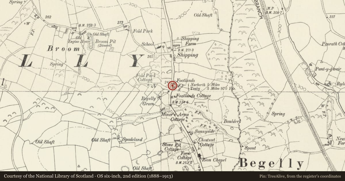
Slide toward Today to fade the historical sheet and see the modern map underneath.
David Rumsey Map Collection, Stanford LibrariesDavid Rumsey Map Collection, Stanford LibrariesDavid Rumsey Map Collection, Stanford LibrariesDavid Rumsey Map Collection, Stanford LibrariesDavid Rumsey Map Collection, Stanford Libraries
5 historical maps cover this location, the earliest the 1636 map "Cornubia : Devonia, Somersetus, Dorcestria, Wiltonia, Glocestria ..." (David Rumsey Map Collection, Stanford Libraries).
Historical maps covering this location
- 1636 · Cornubia : Devonia, Somersetus, Dorcestria, Wiltonia, Glocestria ... (David Rumsey Map Collection, Stanford Libraries)
- 1637 · The fourth table of England. Cornub. Devonia, Somerset etc. (David Rumsey Map Collection, Stanford Libraries)
- 1891 · Sheet 10. Ordnance Survey of England and Wales. . (David Rumsey Map Collection, Stanford Libraries)
- 1898 · 228 Haverfordwest (Hills) (David Rumsey Map Collection, Stanford Libraries)
- 1901 · Sheet 13. (David Rumsey Map Collection, Stanford Libraries)
Cadw's description
Location
In the verge on the east side of the A478, against the wall outside Footlands Farm. North of Begelly.
History
Milestone on the Narberth – Tenby mail coach route, originally operated by the Tavernspite Trust. As a result of the Rebecca Riots the Turnpike Trusts were forced to consolidate within each County and form the "County Roads Board". It was probably after this consolidation that this milestone was erected (1836 - 40).
The plates were likely made by Moss & Sons, elsewhere dated 1838.
Exterior
Milestone, cast-iron plates on stone or concrete possibly replacing the original block, canted front with two triangular-headed faces. On left: 5 / miles / 970 yards / to / Tenby. On right : 5 / miles / to / Narberth’.
The plates are painted white with raised lettering in black and are butted together at 90 degrees, black trim, fixed to a solid backing.
Reason for designation
Included for historic transport interest, as part of the earlier C19 turnpike system.
Nearby in the register
- Zion C. M. Chapel, Schoolroom and House, with Railings and GateReligious, Ritual and Funeraryunder 1 mi
- Begelly HouseDomesticunder 1 mi
- Church of St. MaryReligious, Ritual and Funeraryunder 1 mi
- Milestone opposite Kilgetty Co-opNo class recordedunder 1 mi
Other entries of the same register within about three miles of this one, by straight line.