Cof Cymru: National Historic Assets of Wales · Wales
Railings and gates at St Mary Street War Memorial
Risca, Caerphilly, Wales
A Grade II listed building in Risca, Caerphilly, designated on 14 July 2017.
The record
- Designation
- Listed building, Grade II
- Broad class
- Commemorative
- Date of designation
- 14 July 2017
- Welsh name
- Rheiliau a gatiau gerllaw Cofeb Ryfel St Mary Street
- Community
- Risca
- Unitary authority
- Caerphilly
- Country
- Wales
- Coordinates
- 51.61614, -3.10780
- Cadw reference
- 87742
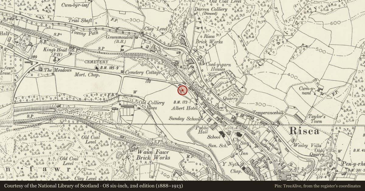
Slide toward Today to fade the historical sheet and see the modern map underneath.
David Rumsey Map Collection, Stanford LibrariesDavid Rumsey Map Collection, Stanford LibrariesDavid Rumsey Map Collection, Stanford LibrariesDavid Rumsey Map Collection, Stanford LibrariesDavid Rumsey Map Collection, Stanford Libraries
5 historical maps cover this location, the earliest the 1636 map "Cornubia : Devonia, Somersetus, Dorcestria, Wiltonia, Glocestria ..." (David Rumsey Map Collection, Stanford Libraries).
Historical maps covering this location
- 1636 · Cornubia : Devonia, Somersetus, Dorcestria, Wiltonia, Glocestria ... (David Rumsey Map Collection, Stanford Libraries)
- 1865 · England and Wales. England No. 6. (David Rumsey Map Collection, Stanford Libraries)
- 1895 · Sheet 11. Ordnance Survey of England and Wales. (David Rumsey Map Collection, Stanford Libraries)
- 1906 · 249 Newport (Hills) (David Rumsey Map Collection, Stanford Libraries)
- 1913 · Sheet 102. Newport. (David Rumsey Map Collection, Stanford Libraries)
Cadw's description
Location
On St Mary Street near the junction with Darran Road.
History
Constructed to enclose the memorial garden.
Exterior
Double gates and piers with flanking curved and ramped panels and shorter piers. Continuous run of railings to each side extending along the St Mary Street frontage of the garden. Wrought and cast iron, piers marked ‘BAKER’S NEWPORT’. Gates with scroll decoration in outer margins and along top rail, dog bars. Cast iron gatepiers with pediment, plain panels on shaft and capital with rosettes. Railings of individual panels with intermediate uprights; each panel of square section rails with plain points, central rail with scroll work crown and ball finial. End rails with abstract horn finial.
Reason for designation
Included for its special architectural interest as a carefully designed set of gates and railings displaying good qualities of craftmanship. Important for its historical value as a visible reminder of the sacrifice of a community during the major wars of the C20. Group value with the nearby war memorial.
Nearby in the register
- St Mary Street War MemorialCommemorativeunder 1 mi
- Canal Bridge over Monmouthshire and Brecon Canal at Darren RoadTransportunder 1 mi
- Canal Bridge over Monmouthshire and Brecon Canal at Darran Road (partly in Crosskeys Community)Transportunder 1 mi
- Entrance Gateway at Churchyard of St Mary RiscaReligious, Ritual and Funeraryunder 1 mi
Other entries of the same register within about three miles of this one, by straight line.