Cof Cymru: National Historic Assets of Wales · Wales
Cross Street Tunnel and Archways
Chirk, Wrexham, Wales
A Grade II listed building in Cross Street, Chirk, Wrexham, designated on 1 October 2007.
The record
- Designation
- Listed building, Grade II
- Broad class
- No class recorded
- Date of designation
- 1 October 2007
- Locality
- Cross Street
- Community
- Chirk
- Unitary authority
- Wrexham
- Country
- Wales
- Coordinates
- 52.96181, -3.07539
- Cadw reference
- 87549
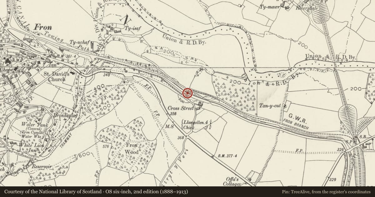
Slide toward Today to fade the historical sheet and see the modern map underneath.
David Rumsey Map Collection, Stanford LibrariesDavid Rumsey Map Collection, Stanford LibrariesDavid Rumsey Map Collection, Stanford LibrariesDavid Rumsey Map Collection, Stanford LibrariesLlyfrgell Genedlaethol Cymru – The National Library of Wales
5 historical maps cover this location, the earliest the 1795 map "To Sir Watkin Williams-Wynn Bart ... the map of the six counties of North Wales is most humbly inscribed by his obedient humble servant" (Llyfrgell Genedlaethol Cymru – The National Library of Wales).
Historical maps covering this location
- 1795 · To Sir Watkin Williams-Wynn Bart ... the map of the six counties of North Wales is most… (Llyfrgell Genedlaethol Cymru – The National Library of Wales)
- 1883 · Watershed map England, Wales 3. (David Rumsey Map Collection, Stanford Libraries)
- 1898 · 121 Wrexham (Hills) (David Rumsey Map Collection, Stanford Libraries)
- 1898 · 121 Wrexham (Outline) (David Rumsey Map Collection, Stanford Libraries)
- 1901 · Sheet 9 and 10. (David Rumsey Map Collection, Stanford Libraries)
Cadw's description
Location
Runs beneath Llangollen Canal, about half way between Froncysyllte and Pentre
History
Probably late C18. An Act to construct the Ellesmere canal, linking the Rivers Dee, Mersey, and Severn was passed in 1793. The engineer was Thomas Telford under the more experienced Principal Engineer, William Jessop. Construction began on the major aqueducts to North and to South of this section in 1795, and navigation began in 1802 when the section of the canal from Chirk to Froncysyllte opened.
Exterior
Tunnel with stone portals, probably late C18. Rubble, with voussoirs to elliptical arches on N and S sides of embankment of canal and tow-path. The tunnel lining has been rendered.
Reason for designation
Listed as a distinctive feature of canal engineering and for its Group Value with other listed items on the Llangollen Canal.
Nearby in the register
- Lime KilnsIndustrialunder 1 mi
- Offa's Dyke: Section N & S of Tan-y-CutLinear Earthworkunder 1 mi
- War MemorialReligious, Ritual and Funeraryunder 1 mi
- Offa's Dyke: Section N & S of Plas-OffaLinear Earthworkunder 1 mi
Other entries of the same register within about three miles of this one, by straight line.