Cof Cymru: National Historic Assets of Wales · Wales
O.M.Edwards Memorial Gateway
Llanuwchllyn, Gwynedd, Wales
A Grade II listed building in Llanuwchllyn, Gwynedd, designated on 11 July 2007.
The record
- Designation
- Listed building, Grade II
- Broad class
- Commemorative
- Date of designation
- 11 July 2007
- Locality
- Llanuwchllyn
- Community
- Llanuwchllyn
- Unitary authority
- Gwynedd
- Country
- Wales
- Coordinates
- 52.85529, -3.66854
- Cadw reference
- 87539
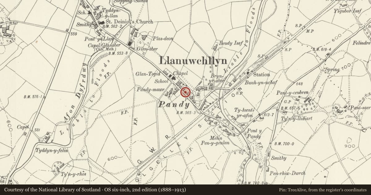
Slide toward Today to fade the historical sheet and see the modern map underneath.
David Rumsey Map Collection, Stanford LibrariesDavid Rumsey Map Collection, Stanford LibrariesLlyfrgell Genedlaethol Cymru – The National Library of WalesDavid Rumsey Map Collection, Stanford LibrariesDavid Rumsey Map Collection, Stanford Libraries
5 historical maps cover this location, the earliest the 1795 map "To Sir Watkin Williams-Wynn Bart ... the map of the six counties of North Wales is most humbly inscribed by his obedient humble servant" (Llyfrgell Genedlaethol Cymru – The National Library of Wales).
Historical maps covering this location
- 1795 · To Sir Watkin Williams-Wynn Bart ... the map of the six counties of North Wales is most… (Llyfrgell Genedlaethol Cymru – The National Library of Wales)
- 1830 · V.3:11-15:XV. Britisches Reich. A. Kon: England. b. Frstenthum Wales: Shire: 37-40 (David Rumsey Map Collection, Stanford Libraries)
- 1883 · Watershed map England, Wales 3. (David Rumsey Map Collection, Stanford Libraries)
- 1899 · 136 Bala (Hills) (David Rumsey Map Collection, Stanford Libraries)
- 1901 · Sheet 9 and 10. (David Rumsey Map Collection, Stanford Libraries)
Cadw's description
Location
Entrance to cemetery (Mynwent y Pandy) on the NE side of the road in the centre of the village.
History
Built some time after 1920 - and designed by R L Gapper - to commemorate O.M.Edwards, who was born in Llanuwchllyn in 1858, and also died there in 1920. Edwards was a highly important and influential figure in Welsh culture and education, through his work in the publication of Welsh books and magazines, through his own writings on the history and culture of Wales, and through his campaigns to have the Welsh language taught in schools. He was also Chief Inspector of Schools of the Welsh Board in Education from 1907, and served briefly as M.P. for Merioneth in 1899-1900.
Exterior
Arched gateway set between short lengths of walling, and with wrought metal gate.
The main structure of the archway is cast concrete, but with polished granite dressings to emphasise keystone and spandrels of the arch. Simple architrave with chamfered plinth and plain imposts supporting shallow entablature. Arch has raking voussoirs, and keystone which is cut from a single block with the spandrels. In it is inscribed the text 'Codwyd y porth hwn er cof am Syr O.M. Edwards 1858-1920'. The gate itself takes the form of a winged angel in wrought metalwork.
Reason for designation
Listed for its historical association as a memorial to O.M.Edwards, and as a fine and unusual example of decorative metalwork in a striking gateway.
Nearby in the register
- Grave of O.M. EdwardsReligious, Ritual and Funeraryunder 1 mi
- Ivy HouseDomesticunder 1 mi
- 5 Station Road (Ty'n Ddol)Domesticunder 1 mi
- 7 Station Road (Ty'n Ddol)Domesticunder 1 mi
Other entries of the same register within about three miles of this one, by straight line.